Geology and Geophysics team
Our ambition
Is to understand the geological structure and tectonic evolution of the Antarctic continent to generate new knowledge about its key role in the evolution of the Earth System itself. Our aim is to use state of the art technologies to explore both the landscape and the deeper structure of Earth hidden beneath the thick ice sheets that cover more than 99% of Antarctica. By achieving this we will produce new geological and geophysical maps and improve models and simulations of key geological processes such as mountain building, basin formation, magmatism and crustal growth.
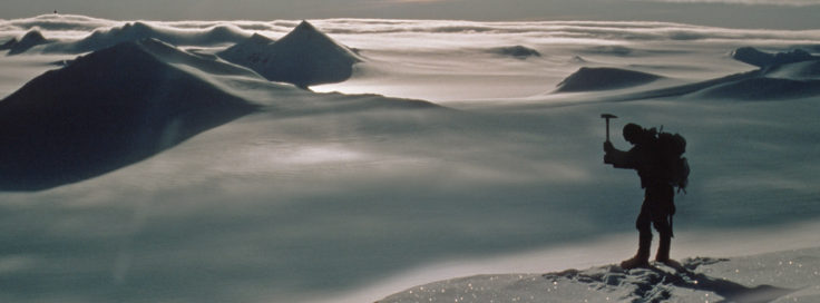
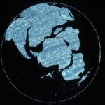
We work collaboratively with national and international partners to deploy a combination of airborne and marine geophysics, spectral remote sensing, field mapping and geochemistry and geochronology to improve our understanding of the geological evolution of Antarctica and its super-continental linkages. Combining this with results from global geological studies we can interpret the role of Antarctica in the breakup of the Gondwana supercontinent as well as the assembly of earlier supercontinents, such as Rodinia and Columbia. Understanding Antarctic geology is also critical for comprehending the internal factors affecting ice flow dynamics and long-term ice sheet stability, in addition to climate and ocean processes. Our research provides unprecedented insights into the structure and evolution of interior East Antarctica and on the fundamental tectonic boundary between East and West Antarctica.
Team priorities
Science
Geology
- Geochemical evolution of the Antarctic Peninsula magmatic system. Investigate the Earth’s crustal growth processes through studies of the Antarctic Peninsula as the southern continuation of the Andean Pacific margin
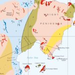
- Geological and geophysical mapping of British Antarctic Territory. Develop a critical base-line for understanding and investigating Antarctica
Geophysics
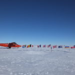
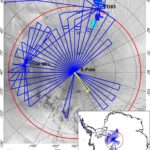
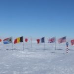
- Unveiling the South Pole Frontier. Assemble a new multinational and multidisciplinary team to explore one of last frontiers on Earth – the South Pole region south of 83⁰S to provide unprecedented insights into the structure and evolution of interior East Antarctica and the fundamental tectonic boundary between East and West Antarctica. The new gravity, magnetic, radar and ice surface datasets we will collect over the South Pole Frontier are urgently needed for global satellite gravity field determination, satellite magnetic studies and satellite altimetry missions
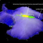
- Revealing the mosaic of East Antarctica. To understand the different geological provinces, and some of the oldest rocks on the planet that are covered by the vast East Antarctic Ice sheet covers. Once thought to be a more or less homogeneous block, ground breaking geophysical exploration is revealing that the interior of East Antarctica is instead a complex mosaic of different geological provinces. Unique opportunities to comprehend the linkages between East Antarctica and ancient (Precambrian) supercontinents like Rodinia and Columbia are beginning to emerge. Comprehending how subglacial geology and geothermal heat flux may affect the largest ice sheet remaining on Earth is also a key priority.
- Evolution of the West Antarctic and Weddell Sea Rift systems. To investigate and create new knowledge about the evolution of crustal and mantle processes that heralded the break-up of Gondwana. The West Antarctic Rift System is one of the largest and yet least understood continental rift systems on the planet. It is particularly critical as it forms the lithospheric cradle for several rapidly changing and potentially more unstable sectors of the West Antarctic Ice Sheet. The Weddell Sea Rift System underlies the Ronne and Fichner Ice shelves that buttress both the West and East Antarctic ice sheets.
Technology, innovation and training
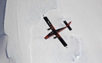
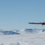
- Airborne gravity, magnetic and radar provide the key tools we use for geophysical exploration of the ice covered Antarctic interior
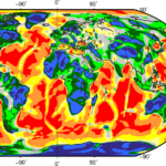
- Provide the broader geosciences community with critical new gravity, magnetic, radar and ice surface datasets over the South Pole region that are urgently required for global satellite gravity (GOCE) field determination, satellite magnetic studies (SWARM) and satellite altimetry missions (Cryosat-2)
- State of the art geochemical analysis and dating is coupled with field based geological exploration and mapping to provide the most complete geological picture to date
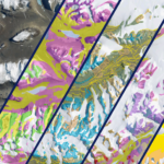
- Using and developing spectral remote sensing methods to map lithology and the target detection of minerals
- Continued commitment to post graduate training through NERC Doctoral Training Partnerships and direct collaboration
Influencing and leading international programmes
- Ongoing track record of successful exploration of remote and hostile frontier regions through major international collaborations such as the AGAP project over the Gamburtsev Subglacial Mountains
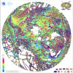
- Play a key role in international projects compiling gravity (Ant-GP), magnetic (ADMAP2), and topographic (BEDMAP2) geophysical data for public release
- Developing an international programme (with Greenland Geological Survey) to identify critical metals using spectral remote sensing
Stakeholder & public engagement
- Producing new geological maps of British Antarctic Territory is part of our commitment to one of our key stakeholders, the FCO
- Provision of geological and geophysical data sets to the wider scientific community
- Publicising and explaining our scientific advances through the BAS Communications Team
- Enthusing next generation of Antarctic explorers & scientist through outreach activities such as the Lyme Regis Fossil festival
- Training early career researchers through master/PhD studentships in partnership with major UK Universities, post-Docs & EU fellowships, such as the Horizon 2020 Marie Curie scheme
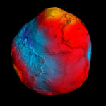
GOCE+Antarctica
GOCE+Antarctica- Dynamic Antarctic Lithosphere -is an international project supported by the European Space Agency (ESA) that is using GOCE satellite gravity gradient data, GPS data and innovative 3D modelling to …PolarGAP
The polar regions have the capacity to amaze and astound, but despite the considerable progress of recent decades we still know far less about them than less remote parts of …Automated lithological mapping using airborne hyperspectral remote sensing
Antarctica is a unique and geographically remote environment. Field campaigns in the region encounter numerous challenges including the harsh polar climate, steep topography, and high infrastructure costs. Additionally, field campaigns …Detecting rare earth elements with remote sensing
Rare earth elements (REEs) are a group of naturally occurring, chemically similar elements present in the Earth’s crust. Over the past decades these elements have become increasingly critical to many …Geological mapping of British Antarctic Territory
Geological maps remain the most effective method of communicating large amounts of geological information. An ongoing project to compile over 50 years of geological field data into new geological maps …Aero geophysical investigation of Institute and Moller Ice Streams
West Antarctic ‘rivers’ of iceAGAP
Exploring Antarctica's 'ghost mountains'British Antarctic Survey unveils pilotless plane for testing in Antarctica
31 October, 2023
Polar science could reach new heights as researchers prepare to test the new Windracers ULTRA autonomous drone in Antarctica this season. A new, state-of-the-art autonomous drone capable of carrying a …
New map unlocks deep digital data of Antarctica’s history
19 May, 2023
GeoMAP Antarctica, an open-access and comprehensive geological mapping database of Antarctica, was released today in Nature Scientific Data. Understanding Antarctica’s geosphere is, and has been, critical for understanding the continent’s …
Antarctica’s magnetic link to ancient neighbours
10 March, 2021
For the first time, an international team of scientists has used satellite magnetic data from ESA’s Swarm mission, together with aeromagnetic data, to help reveal the mysteries of the geology …
Deep channels link ocean to Antarctic glacier
9 September, 2020
Newly discovered deep seabed channels beneath Thwaites Glacier in West Antarctica may be the pathway for warm ocean water to melt the underside of the ice. Data from two research …
Scientists head to Antarctica’s Thwaites Glacier
14 November, 2019
Nearly 100 scientists and support staff depart this week (13 November 2019) for the most ambitious mission to date for Thwaites Glacier in West Antarctica. In the second year of …
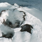
Discovery of rare lava lake on remote sub-Antarctic island
3 July, 2019
A team of scientists has discovered a rare lava lake on a remote and inaccessible sub-Antarctic island. This volcano in the South Sandwich Islands is only the 8th to be identified worldwide to have a persistent lava lake.
Discovery of high geothermal heat at South Pole
14 November, 2018
Scientists have discovered an area near the South Pole where the base of the Antarctic Ice Sheet is melting unexpectedly quickly. Using radar to look through three km of ice, …
Enhanced views of Earth tectonics
5 November, 2018
Unveiling key geological features of the Earth’s lithosphere
“Thermal scar” from dinosaur era still warming base of Greenland Ice Sheet, new findings show
1 August, 2018
A new ‘heat map’ shows, in unprecedented detail, how geothermal heat is escaping through the Earth’s surface beneath the Greenland Ice Sheet. This is critical information for enabling scientists to …
New magnetic anomaly map helps unveil Antarctica
17 July, 2018
The most comprehensive magnetic map of Antarctica ever produced is published this week (15 July 2018). The new map – which includes 3.5 million line-kilometres of magnetic anomaly data collected …
Subglacial valleys and mountain ranges discovered near South Pole
24 May, 2018
Revealing Antarctica’s hidden world
New Antarctic heat map reveals sub-ice hotspots
13 November, 2017
An international team of scientists, led by British Antarctic Survey (BAS), has produced a new map showing how much heat from the Earth’s interior is reaching the base of the …
FEATURED PAPER: Modelling Gondwana break-up
17 November, 2016
Gondwana break-up changed the global continental configuration, leading to the opening of major oceanic gateways, shifts in the climate system and significant impacts on the biosphere, hydrosphere and cryosphere. Although …
New map reveals how little of Antarctica’s rock is ice-free
11 August, 2016
Until now estimates of how much of ice-free rock is exposed in Antarctica were stated as ‘less than 1%’. For the first time scientists from British Antarctic Survey (BAS) have …
Antarctic fossils show creatures wiped out by asteroid
26 May, 2016
A study of more than 6,000 marine fossils from the Antarctic shows that the mass extinction event that killed the dinosaurs was sudden and just as deadly to life in the polar regions.
NEWS STORY: New gravity dataset
23 January, 2016
Scientists now have a new tool to investigate the deep structure of the least understood continent on Earth
PRESS RELEASE: New season – ambitious science
23 November, 2015
New season tackles ambitious science and logistical challenges The British Antarctic Survey (BAS) 2015/16 field season is underway with dozens of scientists and support staff – together with planes and tonnes …
FEATURED PAPER: New geological history for Antarctic Peninsula
29 September, 2015
This paper revised the geological history of the Antarctic Peninsula to show how it developed over the last 500 million years, and used this history to tell us about the …
NEWS STORY: Thousands enjoy Fossil Festival
8 May, 2015
THIS year’s Lyme Regis Fossil Festival was another success, with thousands of people visiting the three-day event.
NEWS STORY: Mountains frozen in time
19 November, 2014
Antarctic “ghost mountains” preserved by ice sheet A new study reveals how the rugged ridgelines of East Antarctica’s ancient and mysterious ‘ghost mountains’ have been preserved for millions of years …
NEWS STORY: Geology under the ice
11 April, 2014
An international research team has generated the first comprehensive map of geology beneath the East Antarctic Ice Sheet that will help to understand long-term changes in the largest ice sheet …
NEWS STORY: Airborne geophysics in the Antarctic
27 January, 2014
In this month’s International Innovation journal Dr Fausto Ferraccioli discusses how airborne geophysics can be used to uncover the geology of Antarctica and explore some of the Earth’s final frontiers. …
NEWS STORY: Giant trench under Antarctic Ice
15 January, 2014
What lies beneath – scientists discover giant trench under Antarctic Ice A massive ancient subglacial trough — deeper than the Grand Canyon — has been discovered by a team of …
NEWS STORY: Mapping Antarctica’s last frontier
13 December, 2013
Mapping of remote Antarctic frontier will help model its reaction to climate change and unlock secrets of Earth’s ancient supercontinents. For the first time scientists have begun mapping one of …
NEWS STORY: Earthquakes strike Scotia Sea
18 November, 2013
Series of large earthquakes in Scotia Sea close to South Orkney Islands A series of earthquakes has been detected in the Scotia Sea region close to the British Antarctic Survey’s …
PRESS RELEASE: Secrets of hidden rift valley
25 July, 2012
Hidden rift valley discovered beneath West Antarctica reveals new insight into accelerating ice loss Scientists have discovered a one mile deep rift valley hidden beneath the ice in West Antarctica, …
PRESS RELEASE: Buried mountain range mapped
16 November, 2011
Gamburtsev Mountains enigma unraveled in interior East Antarctica The birth of the Gamburtsev Subglacial Mountains buried beneath the vast East Antarctic Ice Sheet — a puzzle mystifying scientists since their …
PRESS RELEASE: Underwater volcanoes discovered
11 July, 2011
Underwater Antarctic volcanoes discovered in the Southern Ocean Scientists from British Antarctic Survey (BAS) have discovered previously unknown volcanoes in the ocean waters around the remote South Sandwich Islands. Using …
PRESS RELEASE: New discovery from “ghost mountains”
3 March, 2011
Ice structures found among hidden Antarctic mountains The discovery of numerous large ice structures within Antarctica’s Dome A region, the site of the buried ‘ghost mountains’, reveals new understanding about …
PRESS RELEASE: Mission to buried mountain range
13 October, 2008
Challenge to discover Antarctica”s hidden world Later this month teams of scientists, engineers, pilots and support staff from British Antarctic Survey (BAS), USA, Germany, Australia, China and Japan will join …
SCIENCE AT SEA: Surveys and Sediments
27 March, 2018 by Matthew Chadwick
Matthew Chadwick is a member of the science team from British Antarctic Survey (BAS) currently aboard the RRS Discovery. Read on to gain an insight into what the team have …
SCIENCE AT SEA: Setting off for the Scotia Sea
15 March, 2018 by Zoe Roseby
Zoë Roseby is a member of the science team from British Antarctic Survey (BAS) currently aboard the RRS Discovery. Read on to discover what the team will be investigating in …
ANTARCTIC BLOG: Science from the air #5
26 January, 2016 by Tom Jordan
Wrapping up I have started several of my blog posts saying I am writing in various odd/unusual/uncomfortable locations…the back of a Twin Otter, or in a mountain tent high on …
ANTARCTIC BLOG: Science from the air #4
18 January, 2016 by Tom Jordan
Culture shock Just over two weeks ago I was writing this blog hunched up in a mountain tent, having not washed for a week, and with the company of just …
ANTARCTIC BLOG: Science from the air #3
15 January, 2016 by Tom Jordan
One week on from departing Rothera into the field and the first leg of the PolarGAP survey at FD83 is almost over, I get to sit back, relax a bit …
ANTARCTIC BLOG: Science from the air #2
6 January, 2016 by Tom Jordan
The altimeter in the front of the Twin Otter aircraft is showing 8500 ft as we cruise due south from Rothera research station for the next leg in our PolarGAP …
ANTARCTIC BLOG: Science from the air #1
7 December, 2015 by Tom Jordan
Tom Jordan is part of the PolarGAP project, an ambitious international collaboration which will use airborne geophysics to explore one of the last known frontiers on our planet – the …
An alternative representation of Synthetic Aperture Radar images as an aid to the interpretation of englacial observations [preprint]
21 March, 2025 by Alex Brisbourne, Alvaro Arenas Pingarron, Carlos Martin Garcia, Carl Robinson, Hugh Corr, Tom Jordan, Alvaro Pingarron Arenas
Ground penetrating radar reveals subsurface geometry and ice stratigraphy that contains information about past and present dynamics of the cryosphere. Synthetic Aperture Radar (SAR) is a processing technique based on…What can lithics tell us about hominin technology’s ‘primordial soup’? An origin of stone knapping via the emulation of Mother Nature
15 March, 2025 by Teal Riley
The use of stone hammers to produce sharp stone flakes—knapping—is thought to represent a significant stage in hominin technological evolution because it facilitated the exploitation of novel resources, including meat…Bedmap3 updated ice bed, surface and thickness gridded datasets for Antarctica
10 March, 2025 by Alice Fremand, Andy Smith, David Vaughan, Ed King, Elena Field, Fausto Ferraccioli, Hugh Corr, Hamish Pritchard, James Kirkham, Peter Fretwell, Richard Hindmarsh, Tom Jordan, Richard Hindmarsh
We present Bedmap3, the latest suite of gridded products describing surface elevation, ice-thickness and the seafloor and subglacial bed elevation of the Antarctic south of 60 °S. Bedmap3 incorporates and…Read more on Bedmap3 updated ice bed, surface and thickness gridded datasets for Antarctica
Glacial geology of the Hudson Mountains, Amundsen Sea sector, West Antarctica
15 February, 2025 by Dominic Hodgson, James Smith, Joanne Johnson, Teal Riley
The Hudson Mountains are situated in the eastern Amundsen Sea sector of the West Antarctic Ice Sheet, adjacent to Pine Island Glacier. They form a volcanic field of 17 stratovolcanoes…Read more on Glacial geology of the Hudson Mountains, Amundsen Sea sector, West Antarctica
Dated radar-stratigraphy between Dome A and South Pole, East Antarctica: old ice potential and ice sheet history
1 December, 2024 by Tom Jordan
An array of information about the Antarctic ice sheet can be extracted from ice-sheet internal architecture imaged by airborne ice-penetrating radar surveys. We identify, trace and date three key internal…Tracking the tempo of a continental margin arc: Insights from a forearc succession in West Antarctica
1 November, 2024 by Alistair Crame, Teal Riley
The Fossil Bluff Group of eastern Alexander Island records the exceptional preservation of more than 8 km of Mesozoic sedimentary rocks deposited into an accretionary forearc basin that developed unconformably…Systematic behaviour of 3He/4He in Earth’s continental mantle
1 November, 2024 by Teal Riley
Helium isotopes are unrivalled tracers of the origins of melts in the Earth’s convecting mantle but their role in determining melt contributions from the shallower and rigid lithospheric mantle is…Read more on Systematic behaviour of 3He/4He in Earth’s continental mantle
Reinvestigating the Dufek Intrusion, through joint gravity and magnetic models
1 November, 2024 by Tom Jordan, Teal Riley
The Dufek layered mafic intrusion represents the only exposed, deep-seated, part of the Ferrar Large Igneous Province, which extends >3500 km across Antarctica and into parts of Tasmania and New Zealand.…Read more on Reinvestigating the Dufek Intrusion, through joint gravity and magnetic models
Comparing geophysical inversion and petrophysical measurements for northern Victoria Land, Antarctica
1 October, 2024 by Maximilian Lowe, Robert Larter, Tom Jordan
Bedrock geology from Antarctica remains largely unknown since it is hidden beneath thick ice sheets. Geophysical methods such as gravity and magnetic inverse modelling provide a framework to infer crustal…The 3D Crustal Structure of the Wilkes Subglacial Basin, East Antarctica, Using Variation of Information Joint Inversion of Gravity and Magnetic Data
1 October, 2024 by Maximilian Lowe, Robert Larter, Tom Jordan, Teal Riley
Direct geological information in Antarctica is limited to ice free regions along the coast, high mountain ranges, or isolated nunataks. Therefore, indirect methods are required to reveal subglacial geology and…An UWB UHF Ice-Penetreating Radar for the Thwaites Melt Project
5 September, 2024 by Carl Robinson, Keith Nicholls, Tom Jordan
As a part of the project "Melting at Thwaites grounding zone and its control on sea level" (MELT), we developed a compact 750-MHz ice-penetrating radar for phase-sensitive measurements to infer…Read more on An UWB UHF Ice-Penetreating Radar for the Thwaites Melt Project
Extensive palaeo-surfaces beneath the Evans–Rutford region of the West Antarctic Ice Sheet control modern and past ice flow
7 May, 2024 by Julien Bodart, Tom Jordan
The subglacial landscape of Antarctica records and influences the behaviour of its overlying ice sheet. However, in many places, the evolution of the landscape and its control on ice sheet…A temporal control on the isotopic compositions of the Antarctic Peninsula arc
27 March, 2024 by Alex Burton-Johnson, Teal Riley
Radiogenic isotopic compositions of arc magmas are a key tool for studying active margin evolution. They have two isotopic end-members: melts formed mostly from juvenile asthenosphere and melts sourced from…Read more on A temporal control on the isotopic compositions of the Antarctic Peninsula arc
Source variations in volatile contents of Bransfield Strait back-arc and Phoenix/West Scotia mid-ocean ridge lavas, northern Antarctic Peninsula
20 February, 2024 by Teal Riley
We present the first volatile contents (H2O, CO2, Cl, F, S) of young (< 6 Ma) submarine basaltic glasses from the Phoenix and West Scotia mid-ocean ridges and the Bransfield Strait…Englacial architecture of Lambert Glacier, East Antarctica
20 November, 2023 by Tom Jordan
The analysis of englacial layers using radio-echo sounding data enables the characterisation and reconstruction of current and past ice-sheet flow. Despite the Lambert Glacier catchment being one of the largest…Read more on Englacial architecture of Lambert Glacier, East Antarctica
Polarimetric airborne scientific instrument, mark 2, an ice‐sounding airborne synthetic aperture radar for subglacial 3D imagery
1 September, 2023 by Alvaro Arenas Pingarron, Carl Robinson, Hugh Corr, Tom Jordan, Alvaro Pingarron Arenas
Polarimetric Airborne Scientific INstrument, mark 2 (PASIN2) is a 150 MHz coherent pulsed radar with the purpose of deep ice sounding for bedrock, subglacial channels and ice-water interface detection in…Antarctic sedimentary basins and their influence on ice-sheet dynamics
1 September, 2023 by Tom Jordan
Knowledge of Antarctica’s sedimentary basins builds our understanding of the coupled evolution of tectonics, ice, ocean, and climate. Sedimentary basins have properties distinct from basement-dominated regions that impact ice-sheet dynamics,…Read more on Antarctic sedimentary basins and their influence on ice-sheet dynamics
Continental rifting in the South China Sea through extension and high heat flow: An extended history
1 August, 2023 by Alex Burton-Johnson
We present a new extensional tectonic model for the Cenozoic history of SE Asia and the opening of the South China Sea (SCS), proposing a feedback mechanism by which intracontinental…Antarctic Bedmap data: Findable, Accessible, Interoperable, and Reusable (FAIR) sharing of 60 years of ice bed, surface, and thickness data
17 July, 2023 by Alice Fremand, Andy Smith, David Vaughan, Ed King, Elena Field, Fausto Ferraccioli, Hugh Corr, Hamish Pritchard, Peter Fretwell, Richard Hindmarsh, Tom Jordan, Richard Hindmarsh
One of the key components of this research has been the mapping of Antarctic bed topography and ice thickness parameters that are crucial for modelling ice flow and hence for…Cretaceous – Paleogene tectonic reconstructions of the South Scotia Ridge and implications for the initiation of subduction in the Scotia Sea
7 July, 2023 by Alex Burton-Johnson, Kelly Hogan, Philip Leat, Teal Riley
The Cenozoic development of the Scotia Sea and opening of Drake Passage led to the dispersal of crustal blocks of the North and South Scotia ridges that today have a…Science Leader
Deputy Science Leader
Share this
Featured
Science strategy
Private: Our Grand Challenges for polar science

BAS Science Strategy Executive Group
Geosciences
Geological collections
