Bedmap Himalayas is an ongoing BAS core-funded and grant-funded programme. It aims to measure how much water much is stored as glacier ice in High Mountain Asia.
In warm weather, water from melting glaciers sustains the flow of rivers through dry seasons or droughts. Glacier melt ensures that fresh water keeps flowing after the rains have stopped and the seasonal snow has disappeared. This means that crops can be irrigated rather than failing and hydropower turbines keep turning. Downstream life can continue even in the hottest and driest foothills and plains.
High Mountain Asia has the greatest mountain glaciers outside Alaska. A very large population of 800 million people living downstream depend to some extent on their meltwater. In the Indus catchment for example, 237 million people are heavily dependent on glacier runoff for irrigation in the dry season. This population is growing by 4 million per year. In nearby Bhutan, a quarter of the national income comes from hydropower on glacier-fed rivers.
Bedmap Himalayas is about answering the question: what will happen to Asia’s water supply in future?
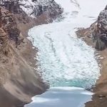
Unfortunately, our hotter climate has pushed Himalayan glaciers out of balance. Now, more ice melts each summer than can be replaced each year by snowfall. The glaciers are shrinking fast: from 2003-2009, this region lost 26 ± 12 billion tonnes of ice per year. This is like losing 12 River Thames each year.
So how long will the ice last? To answer this, we need to know how much ice is still left. We need to know how thick the glaciers are. Unfortunately, this is remarkably poorly known. There are 90,000 glaciers in High Mountain Asia, but hardly any glacier-thickness measurements – Bedmap Himalayas aims to help solve this problem.
Radar can see through ice, but how can we survey in the mountains?
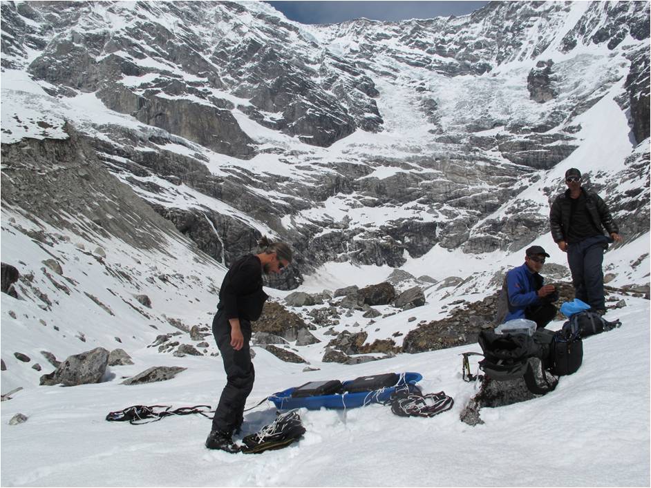
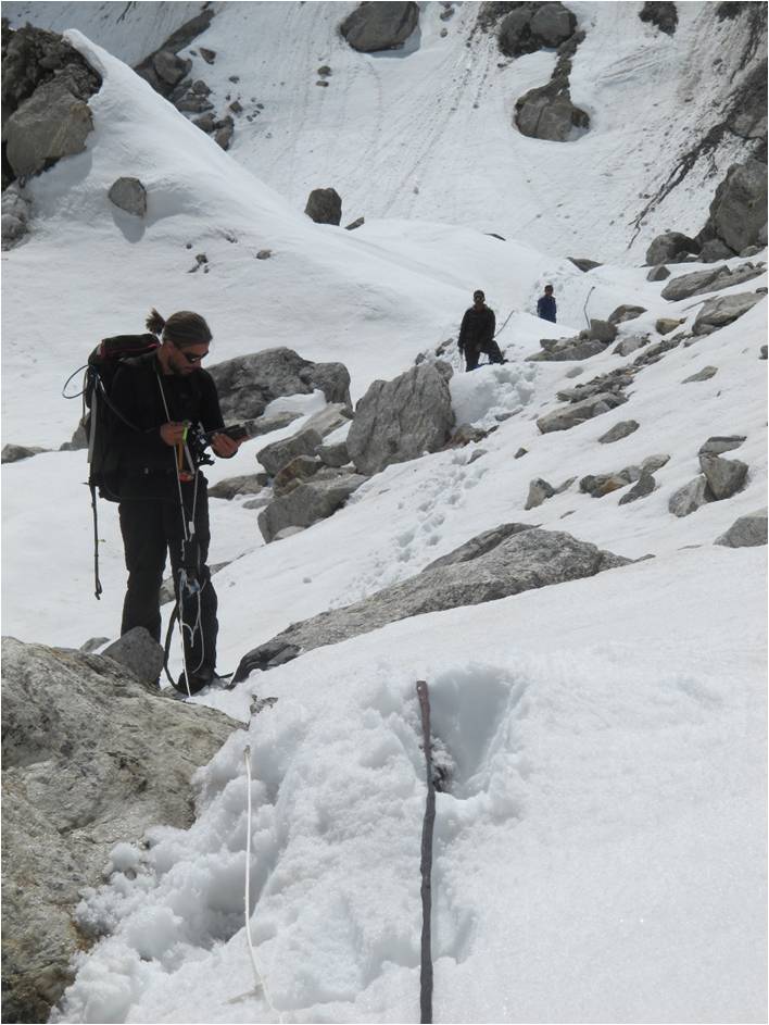
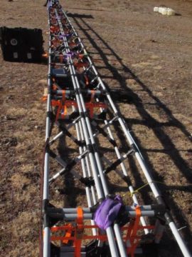
We commonly measure the thickness of the Antarctic ice sheet using radar waves. Transmitted from a sledge or aeroplane, radar waves pass through ice and reflect from the rock below. The time taken for this echo to return reveals the ice thickness. Mountain glaciers are more challenging than ice sheets though, because they are dirtier and wetter. So our first step was to test the radar in these conditions.
To find out which radar frequencies will see through to the bed of Himalayan glaciers, we carried out a pilot study (called ‘Bedmap Himalayas – Reconnaissance’) on glaciers in Nepal. We visited the Langtang Valley in spring 2015, and Nepal’s biggest glacier, Ngozumpa, in 2016. The success of these pilot studies (reported in this paper) meant that we could design and build a helicopter-mounted version of the radar. The mobility of a helicopter makes it very much easier to survey over large areas of extremely rugged mountain terrain.
To the sunlit uplands!
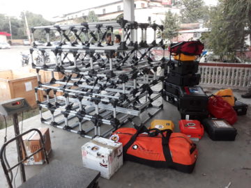
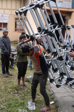
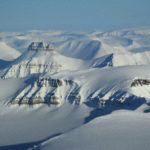
Building a helicopter instrument that is safe to fly and effective is challenging. By late 2019 we were finally ready, after flight-testing in the UK and full survey-testing in high-Arctic Svalbard. We shipped our new Bedmap Himalayas helicopter radar to Nepal. Porters and yaks carried it bit by bit up the steep and rocky paths to an airstrip above Namche Bazaar. The radar en route.
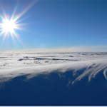
From there, we hooked the radar up to a charter helicopter and sent it out on survey missions across all of the major glaciers of the Khumbu basin. These flew up to more than 6000 m altitude in the Western Cwm of Everest.
The radar frame assembled on the ground and ready to fly. Then airborne!
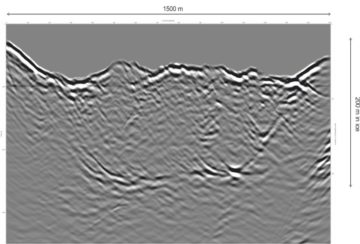
In just a few hours of flying, we covered much of the big reserves of ice stored in the high headwaters of this great Ganges tributary. Our radar crossed areas of ground too difficult, too dangerous and too large ever to survey on foot. From among the radar clutter of echoes from the surrounding mountain walls, crevasses and lakes, we were delighted to see traces of the glacier bed appearing, mapping a landscape under the ice never-before seen by eye. Our first glimpse of the bed deep below the surface in this ‘radargram’.
to develop an ice-sounding radar system for mountain glaciers
to measure glacier ice volume on the river-catchment scale in High Mountain Asia
to help predict the future of Asia’s water supplies
Earlier this year I spent two months doing fieldwork in the Hindu-Kush Himalaya mountain region in South and Central Asia. It hosts the largest volume of ice and snow outside the polar regions and, for this reason, …
How much water the mountain glaciers of the Himalayas contain and how the mighty Thwaites Glacier in West Antarctica will contribute to global sea-level rise form part of the final …
In 2011, Frozen Planet gave BBC viewers an unprecedented insight into life in the Poles. The final episode featured British Antarctic Survey (BAS) glaciologist Dr Andy Smith using explosives to …
Technology pioneered in Antarctica could soon be providing much-needed data on the amount of ice in the glaciers of High Mountain Asia thanks to an ingenious helicopter-mounted, low-frequency radar developed …