Converting paper to pixels
A geologist’s most basic job is to record information about rocks together with their geographical location. This activity is known as geological mapping.
Geological mapping has traditionally used notebooks and paper maps. Although this method has served the science well, it has limitations. It is difficult and time consuming to search paper records for specific information, while the data contained is not readily available for study.
For an organisation such as the British Antarctic Survey, data is a valuable commodity due to the significant investment of staff time and logistical support used to collect it. By making access to this data easier its value to the organisation can be increased. This is best achieved by entering and storing data in a digital database.
By taking advantage of technological advancements in hand-held computers, GPS and batteries, geologists at the British Antarctic Survey have developed a digital mapping system. The mapping system automatically records GPS location information and allows a wide range of geological data to be entered directly into a database.
There are several advantages to using a digital mapping system:
- Greater efficiency and accuracy of mapping.
- Automation of many data collection tasks.
- Increased data security due to the ease of backing-up digital files.
- A wider variety of data is available for analysis and data searches.
- Standardisation of the nomenclature.
The Equipment
To work in a harsh and remote environment like Antarctica, a digital mapping system must be rugged, lightweight and have a low power consumption.
Our current system of choice is based on the following:
- A hand-held computer or PDA, such as an iPAQ hx4700
- Standard 16 channel Bluetooth GPS receiver
- Weatherproof protective case for PDA
Data and observations are input using custom software written within the Geological Sciences Division, which operates within an industry standard mobile mapping program.

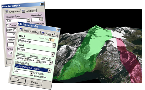
The image above shows a 3D digital view of Cooper Bay, South Georgia, showing the extent of two shear zones highlighted in green and red. Inset: Two data entry pages from the digital mapping system.