UK Polar Data Centre team
The UK Polar Data Centre (UK PDC) is the focal point for Arctic and Antarctic environmental data management in the UK. Part of the Natural Environmental Research Council’s (NERC) Environmental Data Service and based at the British Antarctic Survey, we coordinate the preservation and management of polar data from UK-funded research and support researchers in complying with national and international data legislation and policy.
Our skills and experience reflect the broad and multi-disciplinary nature of polar research that produces data from all the Earth’s spheres. We provide guidance on best practice throughout the data management life cycle from data planning to developing tools for data discovery and access. We also provide operational data services, supporting data capture and transfer systems on UK polar stations, ships and aircraft. BAS ships and aircraft undertake some scientific research outside of polar and other ice-covered regions, therefore we also hold data from other areas within the British Antarctic Survey’s operational footprint.
Our main goal is to ensure that environmental data collected in the polar and cryospheric regions are made available and accessible to all in order to fully realise their reuse potential. This aim is in accordance with the NERC data policy and, for the Antarctic, upholds Article III 1(c) of the Antarctic Treaty. Whilst making data open, we also work to ensure that the original data collectors are properly acknowledged when data are reused through the creation of dataset citations.
As a data centre based primarily on geographical extent rather than scientific discipline we work closely with data scientists at the other NERC data centres and cooperate in many of our data management activities. The UK PDC represents the UK internationally on polar data issues through the SCAR Standing Committee on Antarctic Data Management and the IASC sponsored Arctic Data Committee.
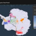
Polar Airborne Geophysics Data Portal
The NERC Airborne Geophysics Data Portal provides direct access to airborne survey data.Atmospheric Data Access System
An online data access tool to discover, visualise and access atmospheric and space weather data holdings from the polar regions.Discovery Metadata System
A web-based system to discover polar datasets collected by UK-funded scientistsHerbarium Collection
A collection of dried plant specimens from the Antarctic, sub-Antarctic and surrounding continents.Geological Collection
Contains over 200,000 individual rock and fossil specimens collected from Antarctica and the sub-Antarctic islands and thousands of meters of sediment core from the surrounding seabed.Bedmap
Bedmap is a collaborative community project with the aim to produce a new map and datasets of Antarctic ice thickness and bed topography for the international glaciology and geophysical community, …60 years of Antarctic ice sheet data released
17 July, 2023
In a significant milestone for Antarctic research, detailed and extensive information on ice thickness and bed topography is now available for the first time in a centralised and standardised format. …
NEWS STORY: Sea ice minimum explained
18 September, 2014
Arctic sea ice summer minimum 2014: A scientific perspective The Arctic sea ice minimum marks the day – typically in September – when sea ice reaches its smallest extent at …
Blog: Launching the Port Lockroy Data Portal
11 February, 2021 by Claudia Havranek
Scientific Data Manager Claudia Havranek, UK Polar Data Centre, presents the Port Lockroy Data Portal. Port Lockroy, Goudier Island, is a popular Antarctic tourist destination. Over the past 20 years …
Bedmap3 updated ice bed, surface and thickness gridded datasets for Antarctica
10 March, 2025 by Alice Fremand, Andy Smith, David Vaughan, Ed King, Elena Field, Fausto Ferraccioli, Hugh Corr, Hamish Pritchard, James Kirkham, Peter Fretwell, Richard Hindmarsh, Tom Jordan, Richard Hindmarsh
We present Bedmap3, the latest suite of gridded products describing surface elevation, ice-thickness and the seafloor and subglacial bed elevation of the Antarctic south of 60 °S. Bedmap3 incorporates and…Read more on Bedmap3 updated ice bed, surface and thickness gridded datasets for Antarctica
A polar oceans shipping information system
1 February, 2025 by Andrew Fleming, Alexander Tate, Andreas Cziferszky, Jeremy Wilkinson, Michael Thorne
Globally, ships above a certain tonnage, as well as an increasing number of smaller vessels, rely on the AIS (Automatic Identification System) to safely navigate around other vessels, which are…The International Bathymetric Chart of the Arctic Ocean Version 5.0
21 December, 2024 by Alexander Tate, Alice Fremand
Knowledge about seafloor depth, or bathymetry, is crucial for various marine activities, including scientific research, offshore industry, safety of navigation, and ocean exploration. Mapping the central Arctic Ocean is challenging…Read more on The International Bathymetric Chart of the Arctic Ocean Version 5.0
Contributions to the development of the next-generation NERC Environmental Data Service: Building Interoperability – a NERC Data Commons RoadMap
1 November, 2024 by Alexander Tate, Alice Fremand, Helen Peat, James Byrne, Petra ten Hoopen
This is a final report from the work undertaken by the NERC Environmental Data Service (EDS) funded by the UKRI Digital Research Programme grant: EDS UKRI DRI Phase 1b. The…High-time-resolution analysis of meridional tides in the upper mesosphere and lower thermosphere at mid-latitudes measured by the Falkland Islands SuperDARN radar
2 February, 2024 by Andrew Kavanagh, Gareth Chisham, Neil Cobbett, Paul Breen, Timothy Barnes
Solar tides play a major role in the dynamics of the upper mesosphere and lower thermosphere (MLT). Hence, a comprehensive understanding of these tides is important for successful modelling of…UAV data management handbook
1 November, 2023 by Alice Fremand
This document gives relevant information related to the management of remotely piloted or uncrewed airborne vehicles (commonly referenced as UAV in this document) data collected as part of NERC funded…Towards a data commons: Imagery and derived data from autonomous and remotely piloted aerial vehicles
1 November, 2023 by Alice Fremand
Scienists are increasingly using autonomous and remotely piloted aerial vehicles (commonly referenced here as UAVs) to collect large volume of data in a range of different scienific domains. These data…Antarctic Bedmap data: Findable, Accessible, Interoperable, and Reusable (FAIR) sharing of 60 years of ice bed, surface, and thickness data
17 July, 2023 by Alice Fremand, Andy Smith, David Vaughan, Ed King, Elena Field, Fausto Ferraccioli, Hugh Corr, Hamish Pritchard, Peter Fretwell, Richard Hindmarsh, Tom Jordan, Richard Hindmarsh
One of the key components of this research has been the mapping of Antarctic bed topography and ice thickness parameters that are crucial for modelling ice flow and hence for…Sustained, year-round oceanographic measurements from Rothera Research Station, Antarctica, 1997-2017
10 May, 2023 by Andrew Clarke, Ali Massey, Alice Clement, Aurelia Reichardt, Emma Stuart, Emma Bolton, Terri Souster, Helen Peat, Hugh Venables, Hollie London, Kate Hendry, Mairi Fenton, Marlon Clark, Michael Meredith, Petra ten Hoopen, Ryan Mathews, Sabrina Heiser, Sarah Reed, Samuel Pountney, Terri Souster, Zoe Waring
Oceanographic changes adjacent to Antarctica have global climatic and ecological impacts. However, this is the most challenging place in the world to obtain marine data due to its remoteness and…A database of marine macronutrient, temperature and salinity measurements made around the highly productive island of South Georgia, the Scotia Sea and the Antarctic Peninsula between 1980 and 2009
12 January, 2023 by Geraint Tarling, Kate Hendry, Petra ten Hoopen, Sally Thorpe
We present a database from substantial collections of macronutrient data made on 20 oceanographic cruises, primarily from around the island of South Georgia and the Scotia Sea. This sector of…A database of zooplankton abundance in the Atlantic sectors of the Southern and sub-Arctic Oceans
14 October, 2022 by Geraint Tarling, Petra ten Hoopen, Peter Ward
Scientific sampling of zooplankton in the Atlantic sector of the Southern Ocean has been undertaken since the 1920s but few analysed datasets are available to the research community. We provide…Polar biodiversity data: from a national marine platform to a global data portal
14 October, 2022 by Geraint Tarling, Helen Peat, Petra ten Hoopen, Peter Ward
Global access to accurate biodiversity data is a prerequisite to our progress in understanding biodiversity dynamics in ecosystems and any changes that are occurring. Despite recent major advancements in sharing…Read more on Polar biodiversity data: from a national marine platform to a global data portal
British Antarctic Survey’s aerogeophysical data: releasing 25 years of airborne gravity, magnetic, and radar datasets over Antarctica
25 July, 2022 by Alice Fremand, Carl Robinson, David Vaughan, Fausto Ferraccioli, Hugh Corr, Helen Peat, Julien Bodart, Tom Jordan
Over the past 50 years, the British Antarctic Survey (BAS) has been one of the major acquirers of aerogeophysical data over Antarctica, providing scientists with gravity, magnetic, and radar datasets…The International Bathymetric Chart of the Southern Ocean Version 2
7 June, 2022 by Alexander Tate, Alice Fremand, Hamish Pritchard, Kelly Hogan, Peter Fretwell, Robert Larter
The Southern Ocean surrounding Antarctica is a region that is key to a range of climatic and oceanographic processes with worldwide effects, and is characterised by high biological productivity and…Read more on The International Bathymetric Chart of the Southern Ocean Version 2
Seasonal and interannual variability of feeding in Antarctic benthos
11 April, 2022 by Andrew Clarke, Helen Peat
The seasonal and interannual variability of feeding in 15 species of benthic marine suspension feeder was studied over 8 yr at Ryder Bay, Antarctica. Feeding was strongly seasonal in bryozoans, gorgonians,…Read more on Seasonal and interannual variability of feeding in Antarctic benthos
The Satellite Risk Prediction and Radiation Forecast System (SaRIF)
14 December, 2021 by Peter Kirsch, Richard Horne, Sarah Glauert
With new satellite constellations being launched into low Earth orbit, the growing use of medium Earth orbit for radio-navigation and timing signals, slot region orbits for telecommunications and the introduction…Read more on The Satellite Risk Prediction and Radiation Forecast System (SaRIF)
Evaluation of SaRIF high-energy electron reconstructions and forecasts
1 December, 2021 by Peter Kirsch, Richard Horne, Sarah Glauert
Increasing numbers of satellites are orbiting through the Earth's radiation belts, and the range of orbits being commonly used is also growing. As a result, there is an increasing need…Read more on Evaluation of SaRIF high-energy electron reconstructions and forecasts

