Seals to act as sentinels of remote Antarctic glacier
Scientists will use two species of seals to investigate a huge glacier in West Antarctica that is at risk of collapse.
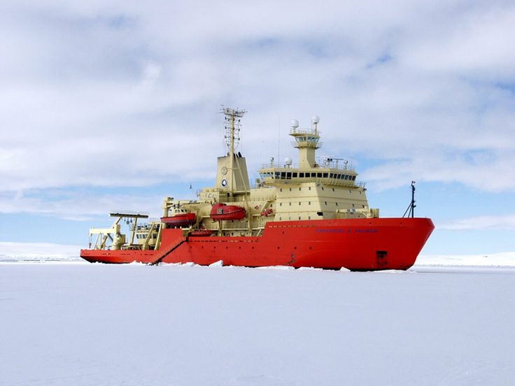
A team of over 20 polar scientists from the UK, US and Sweden set sail this week (29 January) on the first ship-based research expedition to Thwaites Glacier in West Antarctica as part of the International Thwaites Glacier Collaboration.
This cruise is part of a five-year project to understand the contribution that the glacier will make to global sea level.
The researchers, including a team from British Antarctic Survey, will spend over 50 days on board the US icebreaker Nathaniel B. Palmer gathering scientific data to help understand more about the past and current behaviour of Thwaites Glacier, which is the size of Great Britain or the US state of Florida. This is critical for assessing whether the glacier is likely to begin to collapse, and significantly raise global sea levels, within the next few decades or centuries.

Dr Robert Larter, marine geophysicist and chief scientist on board the cruise, says:
“Thwaites Glacier holds the key to a much better understanding of future sea-level rise from this vulnerable part of West Antarctica. This is our first chance to get a deeper understanding of this ‘wild card’ glacier. Examining the seafloor and sediments at the glacier edge will provide an insight into how the ice has behaved in the past relative to records of environmental conditions. This is important for predicting how the glacier may respond to future climate change.”
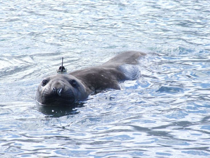
One of the teams on board will use ocean gliders, autonomous vehicles, and will tag seals. Weddell and elephant seals, which haul out on nearby islands, will be fitted with sensors to understand more about their behaviour and the ocean conditions where the ice front of the glacier meets the ocean.
Seal ecologist Dr Lars Boehme from University of St Andrews, who is overseeing the tagging work explains:
“Weddell and elephant seals like hanging out near the ice front or under sea ice, places we find really hard to access. The sensors record details about the seal’s immediate physical environment, which gives us a clearer picture of current oceanic conditions in these remote and inaccessible places.”
Combining the data collected from the tagged seals with records from ocean gliders and autonomous vehicles, will reveal how the glacier interacts with the ocean. If Thwaites Glacier were to melt completely, sea levels would rise by 80cms.

A team from University of Gothenburg will perform the first tests of the Swedish Autonomous Underwater Vehicle (AUV) ‘Ran’, a Kongsberg 3000 m Hugin, in polar waters, and collect oceanographic data from the water column and the sea bed. As well as gaining comprehensive data to assess how the glacier is behaving today, the research expedition will collect data to reconstruct how the Thwaites glacier has responded to past environmental change.
Scientists on board will map the seafloor – using swath bathymetry – to identify how the landscape beneath the glacier influenced its behaviour in the past. Sediment cores collected from the seabed will reveal the extent to which past glacier retreat has been driven by interactions with the ocean.
Dr Rebecca Totten Minzoni, sedimentologist and paleontologist at University of Alabama, says:
“It’s exciting to be part of this ship-based expedition to Thwaites Glacier. This is truly a frontier of science, and the knowledge we will gain has real societal impact. By discovering the history of Thwaites Glacier under past climate and ocean conditions, we can assess the stability of the glacier today. With the majority of the global population living at the coast, including important cultural and industrial centers like my hometown of New Orleans, we need to know how much this vulnerable region of Antarctica will contribute to sea level rise over the coming decades.”
Another team on board will also collect samples of rock, penguin bones and shells from nearby islands to carbon date them. This will reveal how sea level has changed in the past 5000 years and its effect on the ice sheet. All this information will improve reliability of the ice sheet models that are used to predict future sea level change.
The research expedition is part of the International Thwaites Glacier Collaboration, funded by the UK Natural Environment Research Council and the US National Science Foundation: www.thwaitesglacier.org
More information:
The International Thwaites Glacier Collaboration is a £20 million (approx. $25 million) research collaboration, funded by the UK Natural Environment Research Council and the US National Science Foundation, involves over 100 scientists and support staff.
Three of the eight research projects which make up the International Thwaites Glacier Collaboration will be undertaking fieldwork during the 2019 cruise on the Nathaniel B Palmer.
TARSAN – Thwaites-Amundsen Regional Survey and Network
Led by Karen Heywood, University of East Anglia, and Erin Pettit, Oregon State University
Measuring ocean circulation and thinning beneath the floating part of the glacier using state of the art technology such as AUVs and automated land-ice stations, TARSAN will investigate how the ocean and atmosphere are affecting the glacier. The seal tagging aspect of the cruise forms part of the TARSAN Project.
THOR – Thwaites Glacier Offshore Research
Led by Julia Wellner, University of Houston, and Robert Larter, British Antarctic Survey
Investigating sediments deposited in the seas near the glacier, THOR will reconstruct past changes in environmental conditions and the glacier’s response to these, thereby adding context to our projections of future change.
GHC – Geological History Constraints on Grounding Line Retreat in the Thwaites Glacier system
Led by Joanne Johnson, British Antarctic Survey, and Brent Goehring, Tulane University
GHC will identify if and when the glacier retreated in the past, how it recovered, and how it is currently responding to environmental conditions. On this cruise the team will collect information to help reconstruct past sea-level change in the region by mapping raised beaches and dating organic material such as penguin bones from islands in Pine Island Bay.
Details of all the ITGC projects are here: www.thwaitesglacier.org