Scientists begin work counting Arctic walrus
This week, researchers are heading to Svalbard in the Arctic to begin fieldwork to study walrus populations ahead of the next stage in the Walrus from Space project.
Scientists from British Antarctic Survey (BAS), WWF-UK and the Norwegian Polar Institute will do research to validate the walrus counts collected on images from space.
The fieldwork is part of the Walrus from Space research project, a citizen science project to carry out a census of Atlantic and Laptev Sea walrus, using images provided by a satellite imagery company. The project aims to contribute towards the conservation of walrus in the Arctic.
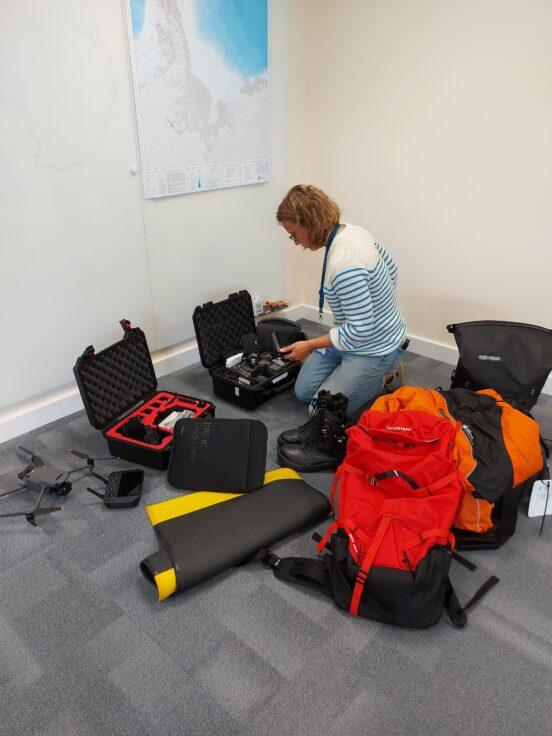
The research team will be based at Ny-Alesund research station for eight days. The team will travel by boat to walrus haul-outs (where they congregate to rest on the land) to count them visually and by using drones. They will compare these to numbers counted from satellite images.

Launched in October 2021, the Walrus from Space research project seeks the public’s help to search for walrus in thousands of satellite images taken from space, with the aim of learning more about how walrus will be impacted by the climate crisis.
So far more than 11,000 members of the public have reviewed over half a million images of the Arctic, detecting walrus and giving scientists vital data on the distribution and timing of walrus populations. The next stage will be to count the walrus in those images and the fieldwork in Svalbard will help to verify the data.
Walrus are facing the reality of the climate crisis: their Arctic home is warming about three times faster than the global average and about 13% of summer sea ice is disappearing per decade.
To help safeguard the future of the walrus, BAS and WWF are working to better understand these Arctic animals, using space satellites to capture thousands of high-resolution images of walrus congregated on more than 25,000km2 of Arctic coastline – an area larger than Wales.
Hannah Cubaynes, Wildlife from Space research associate at British Antarctic Survey, says:
“It’s tremendously exciting to be travelling to see the walrus in their natural habitat. Assessing walrus populations across their whole distribution range by boats or plane is very difficult as they live in extremely remote areas.
“Satellite images can solve this problem as they can survey huge tracts of coastline to assess where walrus are and help us count the ones that we find. If the data we collect from fieldwork matches the data collected from satellite, then we’ll know this is a very effective way forward to benefit walrus conservation efforts.”

Rod Downie, Chief Polar Adviser at WWF, says:
“Walrus are an iconic species of great cultural significance to the people of the Arctic, but despite being big powerful animals, they are increasingly vulnerable to the effects of climate change which is melting their icy home. It’s easy to feel powerless in the face of the climate and nature emergency. This project enables individuals to take action to understand a species threatened by the climate crisis, and to help to safeguard their future.
“What makes this project so special is public participation, and we are grateful to everyone who has taken part so far and those joining the exciting next stage of the project. Together we can help scientists, communities, and decision-makers ensure healthy populations of walrus in the future. What happens in the Arctic doesn’t stay there; the climate crisis is a global problem, bigger than any person, species or region.”
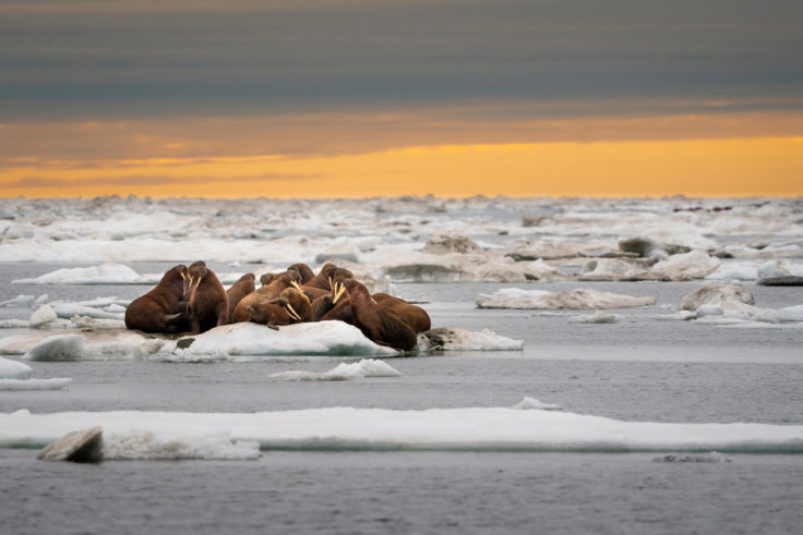
Walrus use sea ice for resting and to give birth to their young. As sea ice diminishes, more walrus are forced to seek refuge on land, congregating for the chance to rest. Overcrowded beaches can have fatal consequences; walrus are easily frightened, and when spooked they stampede towards the water, trampling one another in their panic. Resting on land (as opposed to sea ice) may also force walrus to swim further and expend more energy to reach their food – food which in turn is being negatively impacted by the warming and acidification of the ocean.
In addition walrus can also be disturbed by shipping traffic and industrial development as the loss of sea ice makes the Arctic more accessible. Walrus are facing the full reality of the climate crisis, whilst current population trends are not well understood.
More information
The research team heading to Svalbard includes:
- Peter Fretwell, a Geographic Information Scientist at British Antarctic Survey (BAS).
- Hannah Cubaynes, a research associate at British Antarctic Survey (BAS).
- Jaume Forcada, a marine mammal expert and population biologist at British Antarctic Survey (BAS).
- Rod Downie, Chief Adviser – Polar at WWF-UK.
- Emmanuel Rondeau, an award-winning filmmaker and photographer specialising in documenting wildlife conservation, science, and history.
Walrus from Space: From the comfort of their own homes, aspiring conservationists around the world can study the satellite pictures online, spot areas where walrus haul out onto land, and then count them. The data collected in this census of Atlantic and Laptev walrus will give scientists a clearer picture of how each population is doing – without disturbing the animals. The data will also help inform management decisions aimed at conservation efforts for the species.
Previous population estimates are based upon the best data and knowledge available, but there are challenges associated with working with marine mammals in such a vast, remote and largely inaccessible place. This project will build upon the knowledge of Indigenous communities, using satellite technology to provide an up-to-date count of Atlantic and Laptev walrus populations.
Visit: wwf.org.uk/walrusfromspace to register, and then be guided through a training module before joining the walrus census.
The ‘Walrus From Space’ project, which is supported by players of the People’s Postcode Lottery, as well as RBC Tech For Nature and WWF supporters, aims to engage more than 500,000 people over five years. Over the course of the project counting methods will be continually refined and improved as data is gathered.