New resource for Marine Protected Areas
A new Data Portal is being launched today by the British Antarctic Survey and the Government of South Georgia and the South Sandwich Islands (GSGSSI), which will help to enhance the management of one of the world’s largest Marine Protected Areas (MPAs).
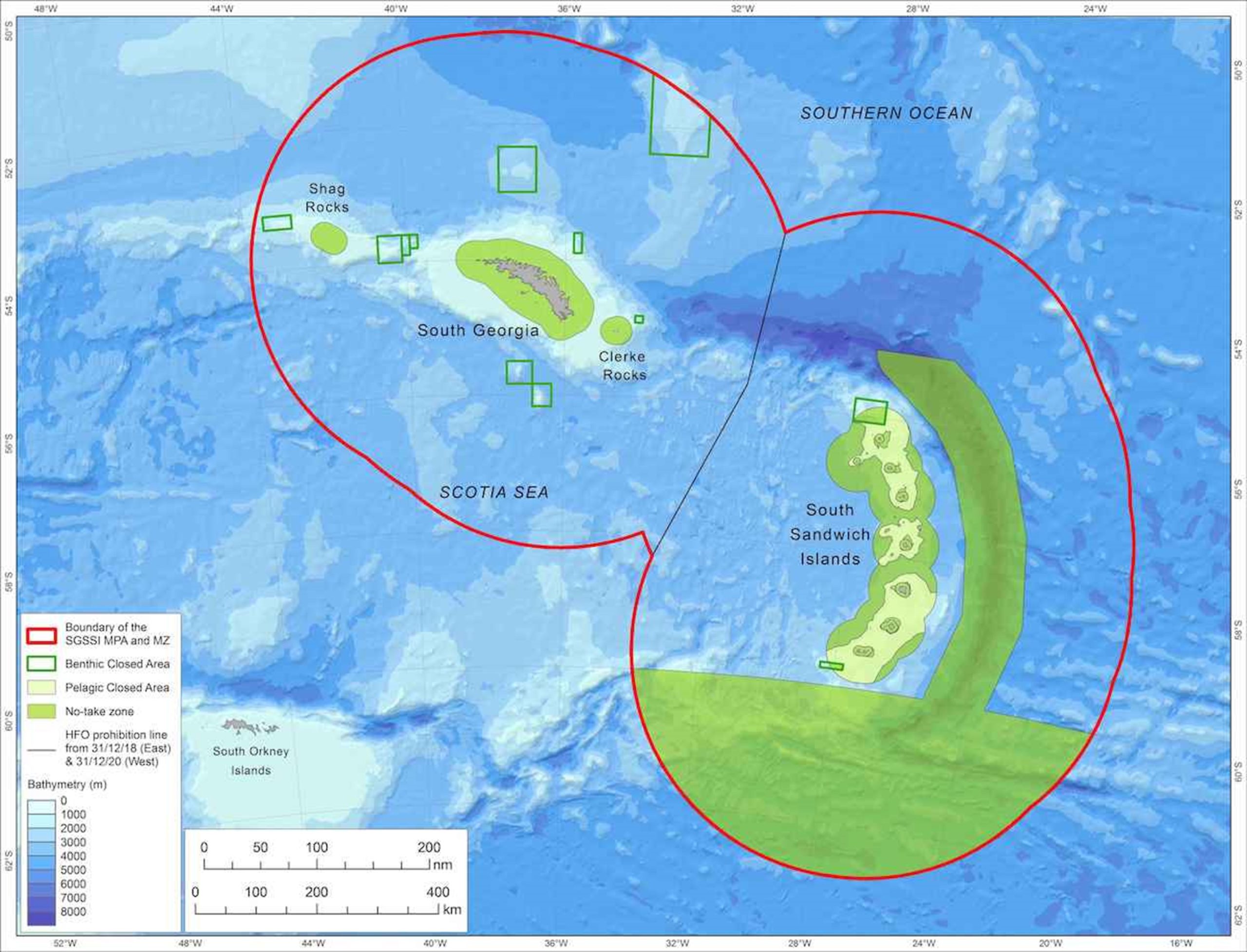
The South Georgia and South Sandwich Islands MPA was established in 2012 to conserve the region’s diverse and abundant marine life, including penguins, whales and seabirds, as well as the fish and krill that these species rely on for food, and unique seafloor ecosystems. The MPA covers an area five times larger than the UK, protecting habitats ranging from coastal kelp forests and glacier-fed fjords, to highly productive open ocean areas, hydrothermal vents, and the deepest trench in the Southern Ocean. Conservation measures include 280,000 km2 of ‘no-take zones’ where all fishing is prohibited in the most sensitive and biodiverse areas, and wider seasonal fishing restrictions to protect predators during the breeding season, as well as a complete ban on exploitation of minerals and hydrocarbons, trawling on the seabed, and the use or carriage of heavy fuel oil by all vessels.

The initial design of the MPA and the additional conservation measures announced in 2013 and 2019 have been founded on the best available scientific advice, and evidence-based management continues to be a priority for GSGSSI. The new MPA Data Portal provides a platform for managers, scientists and stakeholders to access the latest information on the status and trends of marine biodiversity, environmental conditions and human activities. It contains over 150 interactive maps and data summaries, which are linked directly to the South Georgia online GIS and the UK Polar Data Centre Discovery Metadata System.
Development of the new Data Portal was part of a Darwin Plus funded project on ‘Building data resources for managing the SGSSI Marine Protected Area’, undertaken by BAS and the UK Polar Data Centre in partnership with GSGSSI, and with input from other scientific experts and stakeholders.
Dr Susie Grant, BAS marine biogeographer, and project leader says:
“The new Data Portal highlights the enormous amount of scientific information and research effort that contributed to the designation of the MPA, and which continues to advance our understanding of the ecosystem and to ensure that it is protected into the future.
Jonathan Handley, project lead of the Birdlife International Marine Programmes added:
“It’s excellent to see this new Data Portal now live and available to stakeholders. It is an essential tool that has greatly contributed to the BirdLife International Marine Programmes’ ability to support identifying and monitoring a global network of important sites for bird species.”
The Data Portal also contains a Research and Monitoring Plan for the MPA, developed in collaboration with scientists and stakeholders to guide future scientific activities that will contribute to an increased understanding of the SGSSI marine ecosystem, assess the nature and extent of future change, and provide information to evaluate the effectiveness of the MPA.
The South Georgia and South Sandwich Islands MPA is subject to review every five years, to ensure that its conservation measures continue to be effective, and to incorporate the most up to date scientific information.
Laura Sinclair-Willis, GSGSSI Chief Executive Officer says:
“The launch of the South Georgia Data Portal underlines the Government’s commitment to openness and evidence-based decision making. Publication of these data further demonstrates the Government’s position as a trusted voice in environmental science, engaged in world-leading work that has a measurable positive impacts.”
The full data source available to view now online: SG_MPA_dataportal – Log In (mpa-dataportal.gs)