New magnetic anomaly map helps unveil Antarctica
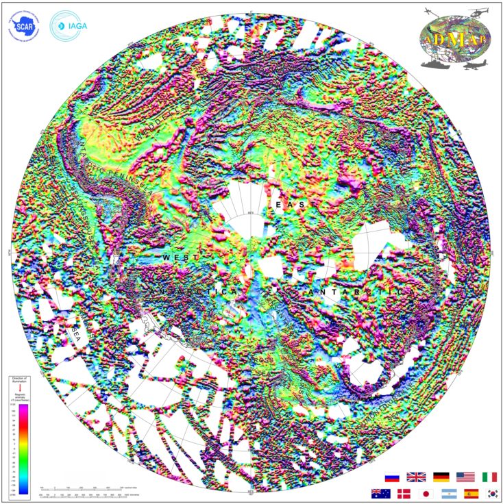
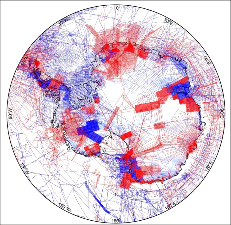
The most comprehensive magnetic map of Antarctica ever produced is published this week (15 July 2018). The new map – which includes 3.5 million line-kilometres of magnetic anomaly data collected over the past 50 years – sheds new light on the structure and evolution of the Antarctic continent and its surrounding oceans.
Antarctica’s remoteness and harsh conditions make it a supremely challenging environment for researchers who study the continent. For geoscientists, however, research is particularly tough because the rocks they seek to understand are buried deep beneath the thick ice sheet that blankets the continent.

Less than 1% of Antarctica’s geology is visible above its icy mantle, so in addition to using traditional geological mapping, geoscientists rely on magnetic anomalies to help them interpret the fundamental building blocks of the continent and their tectonic boundaries.
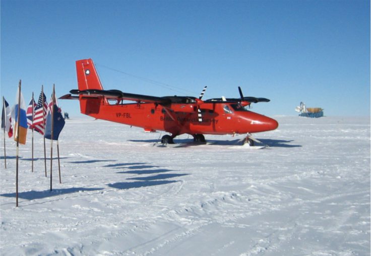
The new map, ADMAP-2.0, uses data collected from aircraft and ships. It shows variations in Earth’s magnetic field caused by differences in the crust’s magnetisation, which help reveal the geology hidden beneath the Antarctic ice sheet and South Ocean.

ADMAP-2.0 doubles the coverage of the first version of ADMAP released in 2001. It includes data collected over previously unexplored sectors of Antarctica (e.g., Dronning Maud Land, Wilkes Land) and huge mountain ranges such as the Gamburtsev Subglacial Mountains and the Transantarctic Mountains. Both the new map and its datasets are freely available.
Dr Alexander Golynsky from VNIIOkeangeologia (Russia), lead author of the paper, says:
“The project shows the full potential of international collaboration to obtain such continental-scale compilations. By including large new datasets and using advanced re-processing and data merging techniques we have vastly improved the Antarctic magnetic anomaly map”.
According to Dr Fausto Ferraccioli, Science Leader at British Antarctic Survey and co-chair of the ADMAP international steering committee:
“Our new map helps reveal the crustal architecture of the entire Antarctic continent with much more detail than before. It allows us to image many of the key geological features hidden under the thick ice sheets that blanket the continent.”
The new map opens up exciting new research into the geological processes that led to the formation and evolution of Antarctica, which was once a centrepiece of Gondwana and earlier supercontinents such as Rodinia and Nuna.
“Until now we have lacked a coherent geophysical compilation needed to trace much better-understood geological features from other continents into Antarctica. This fantastic new tool will help us answer many geological questions, such as how Gondwana broke apart and also help us understand how Antarctica’s geology influences the way in which its ice sheets flow today,” Ferraccioli explains.

ADMAP co-chair, Dr Graeme Eagles from the Alfred Wegner Institute says:
“Our next challenge is to fill in the remaining magnetic data gaps by exploring the most remote frontier areas of Antarctica building on the success of our international collaboration”.
ADMAP-2.0 involved scientists from 22 institutions across 11 nations, and the Korean Polar Research Institute funded the map compilation.
“New magnetic map of the Antarctic” by Alexander V. Golynsky et al is published this week in Geophysical Research Letters. Read the paper here: https://agupubs.onlinelibrary.wiley.com/doi/10.1029/2018GL078153