Technology pioneered in Antarctica could soon be providing much-needed data on the amount of ice in the glaciers of High Mountain Asia thanks to an ingenious helicopter-mounted, low-frequency radar developed by researchers at British Antarctic Survey.
After successfully testing the new equipment at the UK Arctic Research Station at Ny-Ålesund this spring, a team from BAS hopes to be heading to the Indian Himalayas in Spring 2019.
The radar was developed by engineers at the British Antarctic Survey. Photo credit: Ed King
Leading the team is BAS glaciologist Dr Hamish Pritchard, whose work focuses on the two great glaciology issues of a warming world: rising sea level due to melting ice sheets, and the future of mountain glaciers as a water resource.
“There are two ‘billion-people problems’ associated with glaciers. One is to do with melting ice sheets and sea-level rise, the other relates to water resources from mountain glaciers,” he says.
Measuring the volume of ice in High Mountain Asia’s glaciers is important because countries in the region have large, growing populations and highly water-dependent economies. For many communities, ice melt from glaciers provides a lifeline of water in summer, particularly during droughts when the rains fail.
Over many years BAS researchers, together with scientists from other nations, have used radar to collect a rich dataset on the thickness of the Antarctic ice sheets. This data, coupled with climate change models, is vital for making accurate predictions of future sea-level rise.
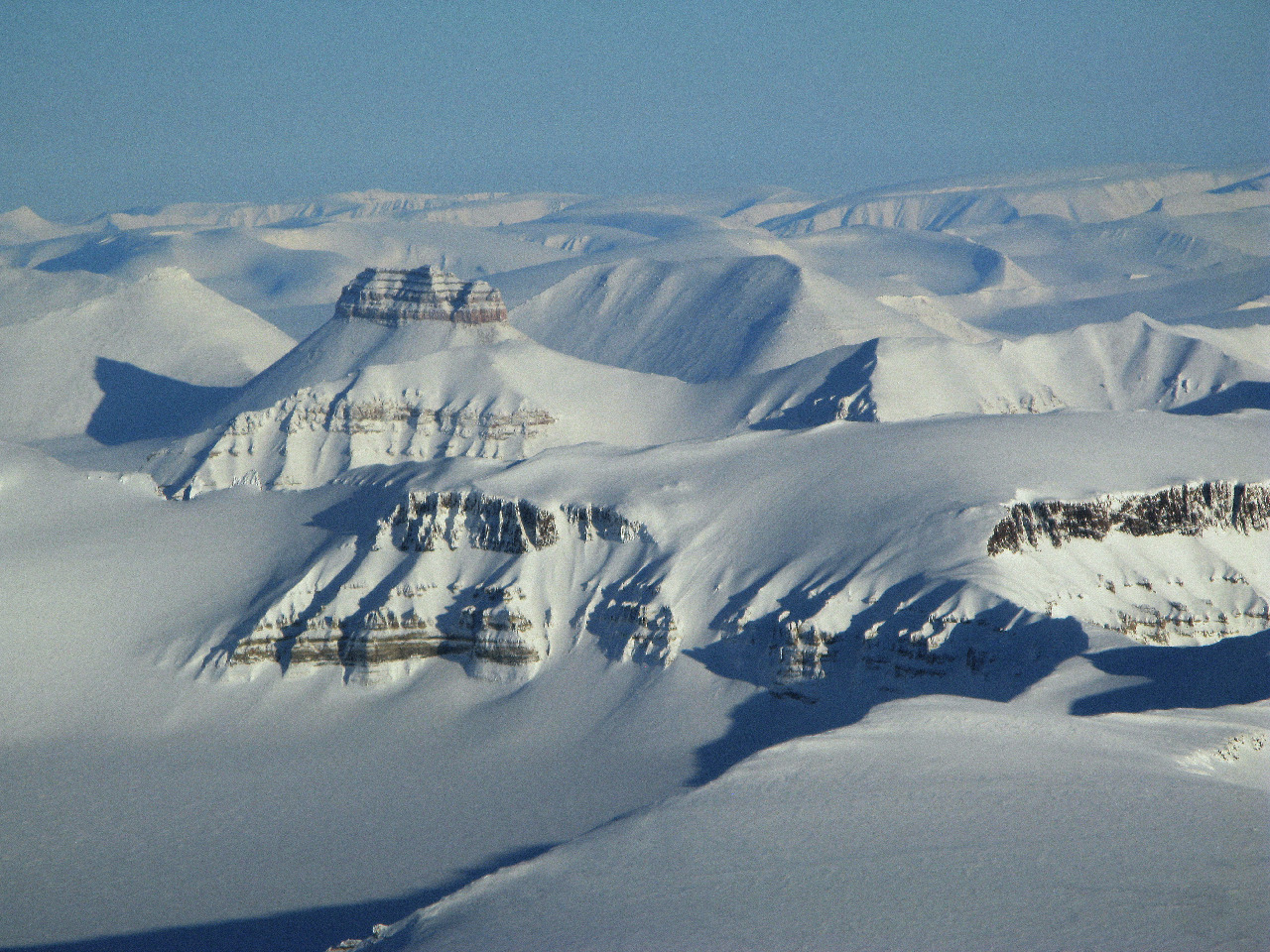
Compared with Antarctica, however, very few measurements have been made of how much water is locked away in the 90,000 glaciers that spill from Asia’s mountain ranges – from the Tien Shan and Pamirs to the Hindu Kush and Karakoram.
“The dearth of data is due to several factors”, says Dr Pritchard: “It’s partly political – these mountain ranges cross many borders. They’re also at high altitude. We are mainly interested in the lower tongues of these glaciers, but even these can be at 4,000 – 5,000m. To work there you need to walk in and acclimatise, and once you’re there, the glaciers are very different from those in Antarctica.”
In order to penetrate Antarctica’s very thick ice cover – which can be more than 3,000m deep – BAS scientists have developed very low frequency radar systems capable of reaching bedrock. To transmit and receive such low frequency radar, the equipment has very long antennae.
Despite the remoteness and harsh conditions of the Antarctic, the relatively smooth-surfaced ice sheets mean that radar equipment can be towed by snowmobile to measure the thickness of the ice.
According to Dr Pritchard:
“As the frequency drops, the longer the antennae have to be. In Antarctica we can use a ground-based system towed over the snow by snowmobile. The snowmobile is connected by ropes to a line of two sledges, the first has a receiver and a pair of antennae front and back, the second has a transmitter with another pair of antennae.”
For Dr Pritchard and the BAS team, the challenge has been to adapt this low frequency radar to High Mountain Asia:
“Glaciers there are very rough, and often completely covered in a layer of rock debris that’s fallen from the mountains. You can’t drive over it – it’s even difficult to walk across.”,
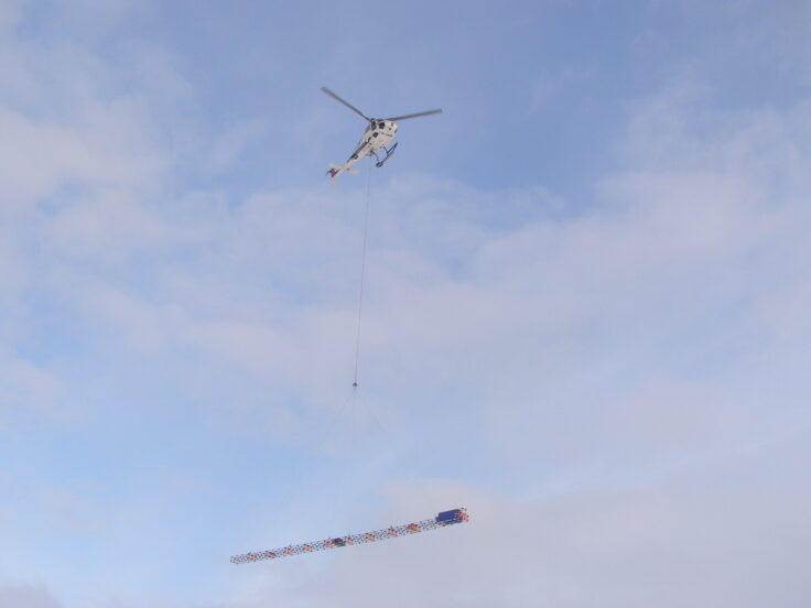
Because aeroplanes are poorly suited to flying among such high-altitude mountains, the BAS team opted for a helicopter-mounted low frequency radar system. Helicopters are better able to cope with the terrain and are easier to charter in-country. But building a long yet transportable radar system and mounting it safely under a helicopter was a major challenge.
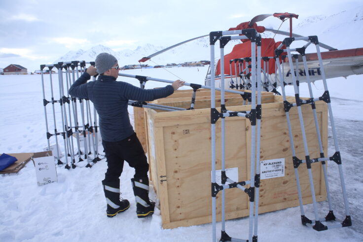
During 2017, engineers at BAS constructed a modular frame made from plastic tubing. The 20 metre-long structure, which resembles an arrow-shaped crane arm, can be strapped together and slung beneath the helicopter.
Preparing the radar for testing beneath the helicopter at the UK Ny-Alesund research station. Photo credit: Ed King
After safety testing the equipment at a local Cambridge airfield, the team then needed to test it over ice with the radar running.
“There aren’t many places you can fly around testing radar transmitters, let alone over ice, so when we got the opportunity to piggyback on a Norwegian Polar Institute project at Ny-Ålesund, which was using a helicopter to support field teams, we jumped at the chance,” says Dr Pritchard.
The tests were so successful that the BAS team has funding to join Indian researchers in Spring 2019 to use the equipment in the Himalaya. If all goes according to plan, it will at last provide a viable means of measuring the volume of ice in the glaciers of High Mountain Asia.
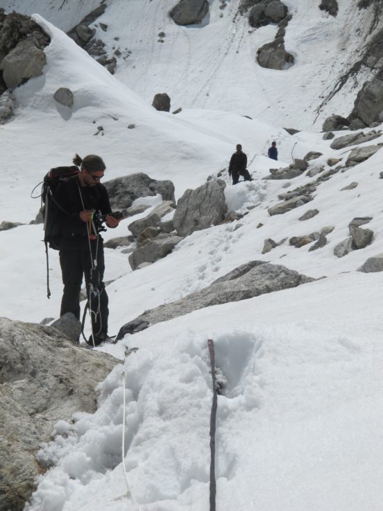
Dr Hamish Pritchard working in the Himalaya in 2017. Photo credit: Dr Ian Willis, SPRI
“People’s dependence on these glaciers is a complicated issue,” he concludes. “The Ganges and Brahmaputra have a strong summer monsoon, so are rarely short of water in summer, but the Indus and Aral Sea basins are much less monsoonal so summer melt from glaciers comes more into play.”
“And even monsoonal areas can suffer extreme droughts of 2-3 years. Then, all water supplies – the rivers, reservoirs and ground water – decrease, except the glaciers, which keep supplying melt water. That’s why it’s vital to find out how much ice is there.”