First science on board RRS Sir David Attenborough
16 May, 2022 Rothera
Britain’s new polar ship, RRS Sir David Attenborough, has reached another exciting milestone, completing its first ever scientific assignment – retrieving a scientific mooring!
RRS Sir David Attenborough is currently on its way back to the UK, after completing its first season in Antarctica. After departing the UK in November, the ship made the epic journey to Antarctica where it’s had a busy season so far, completing ice trials and bringing people and vital supplies to British Antarctic Survey’s research stations. Earlier this year, the ship also carried out its first science task – retrieving and redeploying a scientific mooring from Ryder Bay, close to Rothera Research Station. We spoke to some of our oceanography team to find out more!
So, what is a mooring?
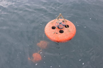
Scientific moorings are essential tools for oceanographers – scientists who study the ocean. Although there are several different kinds of moorings, they usually consist of a large float connected by a long wire to a heavy weight, which sits on the ocean floor and holds the mooring in place. Attached to the wire (which can be 100s or even 1000s of metres long!) are instruments that collect various data about the ocean. Moorings in Antarctica are almost always sub-surface; the float sits below the ocean surface where they won’t be damaged by icebergs or sea ice!
And why do we use them?
Measurements from ships give a snapshot of the ocean at that moment in time, and satellites are extremely useful at monitoring changes that happen at the surface of the ocean. However, there are many ocean processes that take place over many months or years, and which happen deep in the water – and we need a way to study and monitor this over longer periods. That’s where moorings come in. They’re particularly useful at collecting data over the winter months when its difficult to access many regions in the Southern Ocean because they’re covered in ice. These instruments can be left in place to collect data for several years, helping us understand changes in the ocean between seasons and years. If moorings are redeployed periodically, we can then build up a long-term picture of how the ocean is behaving and changing over years, or even decades.
What instruments were on this particular mooring?
Almost all moorings collect basic information about the ocean, such as the temperature, salinity and velocity of the water. They take these measurements periodically, anything from every few minutes to every month, and contribute to long-term data sets, such as the Rothera Time Series (RaTS) project, which collects weekly oceanographic and biogeochemistry data. This project has been running for 25 years and is one of the longest time series of continual ocean measurements in Antarctica. The Rothera Time Series is extra special because we take measurements year-round, giving us information on crucial processes and changes that happen in winter.
Current profiler
This mooring was also fitted with a current profiler. This gives us information about ocean currents – both the speed the water is moving and the direction – which is crucial in helping us understand ocean circulation and mixing. These are key processes in moving and spreading important substances in the ocean (such as heat and carbon) around other locations. The data are downloaded from the instrument whenever the mooring is recovered and redeployed; when analysed alongside other current data and computer simulations, they give us new insight into how the ocean impacts climate change, ocean productivity and the ecosystem.
Sediment trap
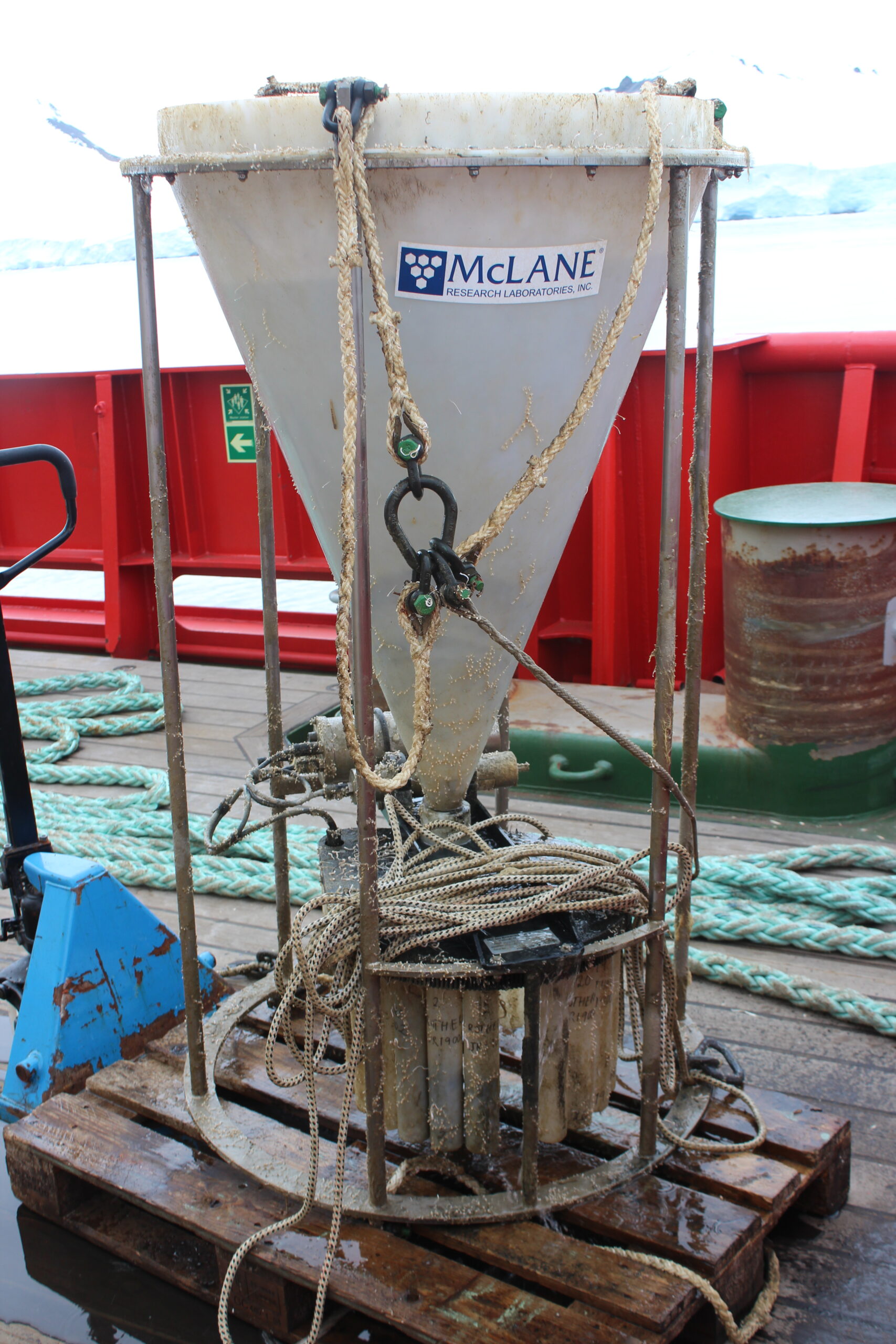
Sediment traps collect particles falling from the ocean surface to the ocean floor – this could be anything from organic matter to synthetic debris. The traps consist of a large funnel, which catch the sinking debris and collect it in the 21 collection bottles. The sediment trap is pre-programmed to rotate each bottle underneath the collecting cone for a specific period of time. The rest of the time, the bottles are closed. We will use the samples collected to find out more about the ocean’s ability to move carbon from the ocean surface to deeper waters, which has clear implications for our understanding of the ocean’s role in regulating our climate. We’re also interested in how the amount of nutrients in the water affect this transfer of carbon. For example, this area of the Southern Ocean has huge amounts of iron. This can fuel primary productivity – the production of organic matter by tiny plants called phytoplankton – which in turn increases the amount of carbon uptakes from the atmosphere and transported to the ocean floor.
The samples collected from this sediment trap will also be used to investigate the amount of plastic sinking in the deep seawater. Microplastic debris interact with zooplankton, tiny organisms that promote the transport and storage of large quantities of carbon to the deep oceanic sediments through the sinking of their carbon-rich faeces. These organisms may ingest microplastic, repackage them into their faeces, and lower the sinking velocity of them. Sediment trap samples will be analysed in the laboratory to investigate how the presence of microplastic reduce the amount of carbon that reach the sea sediment and in turn the capability of the ocean to regulate atmospheric CO2 emissions.
Why was the mooring in this particular location?
The mooring was deployed at this particular location to augment the weekly ocean data we obtain from the RaTS programme, adding more regular data on ocean temperature and salinity and extra data on ocean currents and mixing that RaTS alone does not provide. The datasets will be analysed together to give a fuller understanding of what is causing ocean changes in this rapidly-changing region, and what the impacts of those changes will be.
As in many areas, the nearby glaciers that flow into Ryder Bay have been retreating for decades, driven at least in part by warm (above freezing) ocean waters. Understanding how and when these waters move close to the glaciers and how they are affected by factors such as winter sea ice cover is crucial to predictions of how things will change in the next few decades.
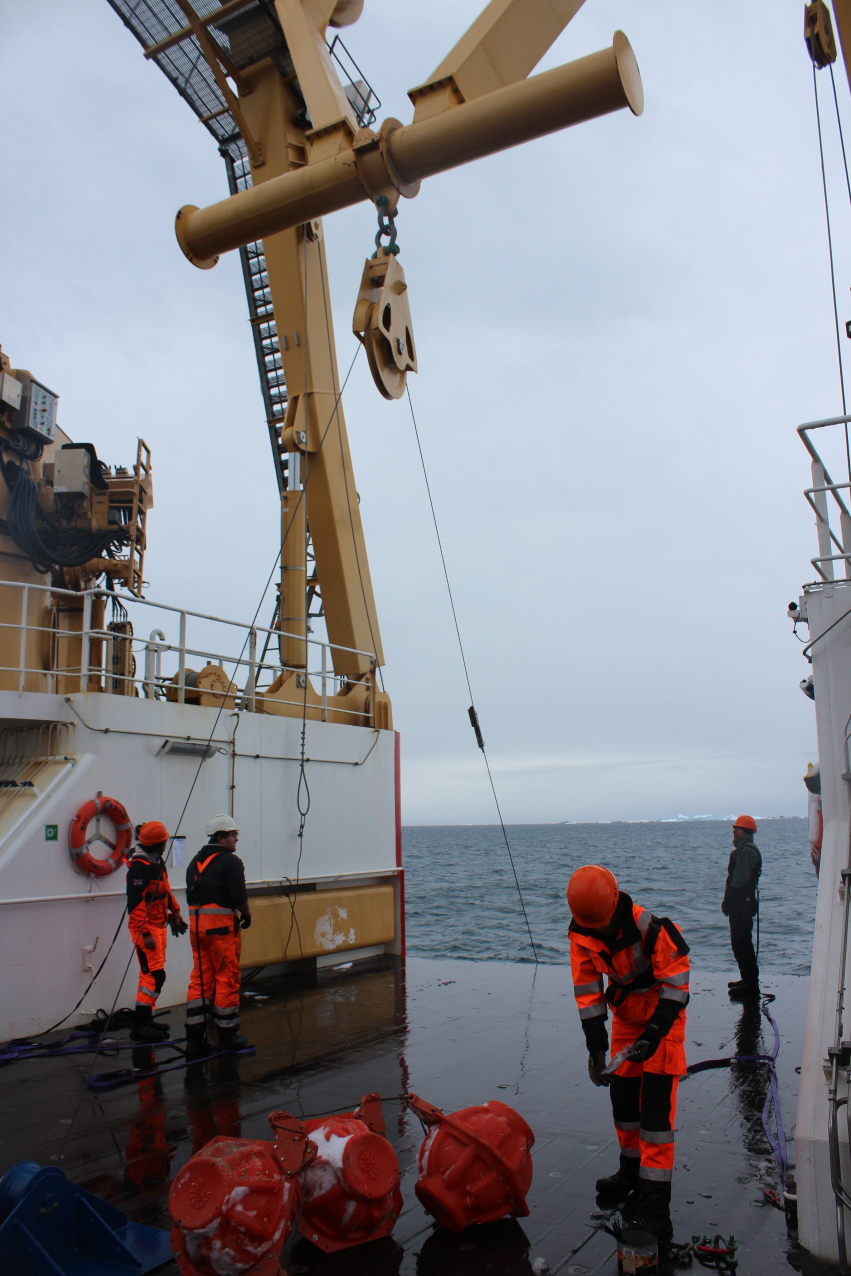
How do you deploy and retrieve a mooring? How do you find them to collect them?
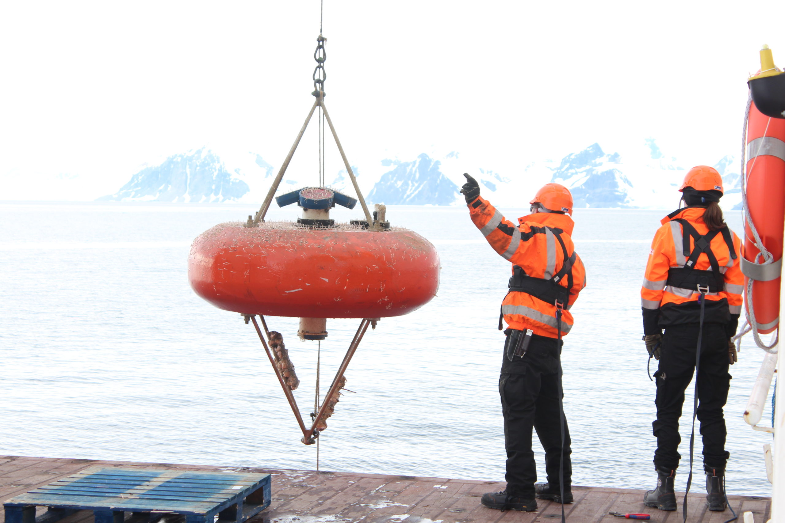
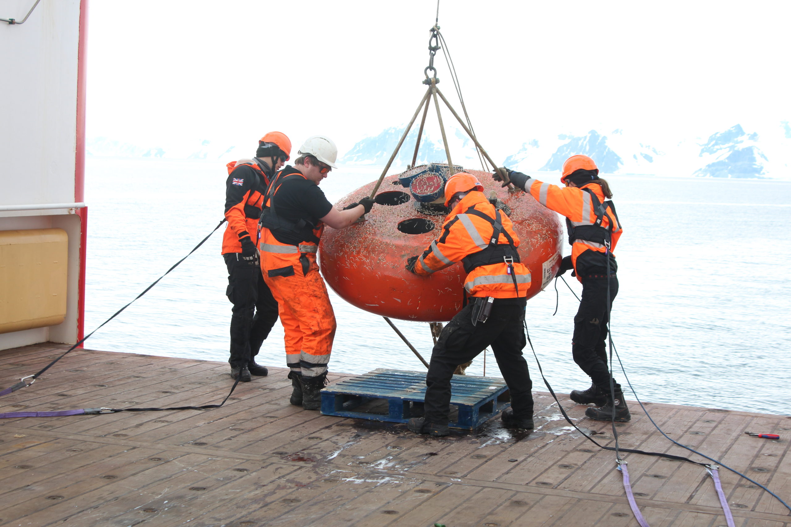
Moorings can be deployed either weight first or float first. Weight first means everything is under tension on deck during deployment, which is harder, but the mooring falls to a more predictable spot on the seabed. If we don’t need to be so precise, then it can be easier to deploy the weight. The releases above the weight send acoustic signals, which are used to triangulate where the mooring has landed, so you know where to look during recovery.
For recovery, a coded acoustic signal is sent to the releases making them let go of the weight. The buoyancy on the mooring, which has been keeping it upright then brings the mooring to the surface where it can hopefully be seen. Location beacons are fitted in case it drifts away, or in case the releases fail early. A trailing rope is then snagged with a grappling hook and the recovery can then start using the ship’s winches.
Thanks to Anna Belcher, Alex Brearley, Clara Manno, Mike Meredith and Hugh Venables for answering our questions! Keep an eye on our website and social media channels for more updates about RRS Sir David Attenborough.