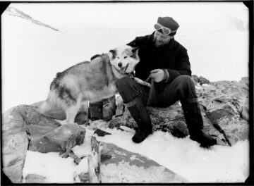
In early 1945 the SS Eagle under Captain Robert Sheppard arrived at Deception Island carrying new personnel, stores, equipment, and, crucial to the expedition’s field work, twenty-five huskies from Labrador Canada. These were the first dogs to come south as part of Operation Tabarin. The dogs were bound for the new base at Hope Bay (Base D), destined to be the centre of sledging operations during 1945. The lack of dog teams had limited field work at Port Lockroy the year before. With dogs now available the new expedition commander, Andrew Taylor, could pursue a more ambitious schedule of survey and travel once Base D was established.
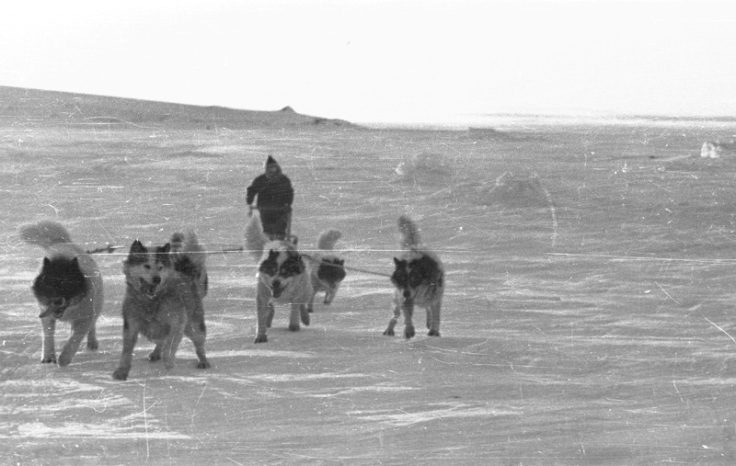
Stores officer, Gwion Davies, describes how he learned from the dogs:
Initial intentions for the first sledging trip with the dogs were focussed on the east coast of the Graham Land Peninsula. Plans for this trip remained fluid for several months, and changed in response to the loss of a number of dogs, the fact that the Eagle had not been able to lay any depots in this area before her premature return to Port Stanley. Whatever the final details, any such trip required careful preparation:
“Each man was apportioned some preparatory work – James, the dogs and sledges, Russell the food supplies, Lamb the cooking utensils, paraffin, primuses, etc., while I looked after the survey equipment.
[…]
The two seven dog teams were equipped with spare harnesses, dog boots, chains, tethering lines, sledge repair outfits, etc.
[…]
Largely governed by the ration scale used by the British Graham Land Expedition, but making minor alterations to suit our bulk supplies in some individual items, Russell prepared the food on the following man-day basis;
Biscuits – 3.1 oz.
Cocoa – 0.6
Oats – 2.0
Chocolate – 2.4
Pemmican – 5.6
Sugar – 3.2
Milk Powder – 2.0
Butter – 5.6
Nescafe – 0.4
Tea – 0.4
Dried apples – 0.4
Dried onions – 0.2
Pea flour – 1.6
27.5 oz. per man per day.
[…]
Source: Andrew Taylor’s survey report. (Archives ref: AD6/1D/1945/K1)
The scientific work in the field was allocated in the following way: James – Sea Ice Observations, Met Records; Russell – Glaciological observations and descriptions, Radio and Time signals; Lamb – Botanical Collecting, Geological Collecting; Taylor – Geographical Descriptions, Geological Collecting, Plotting of Notes (survey).
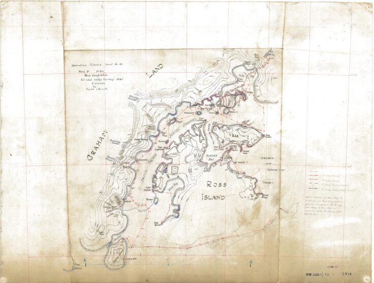
On 8th August, David James, Victor Russell, Ivan Lamb and Taylor started out on the first long-range dog-sledging trip of Tabarin, travelling down Crown Prince Gustav Channel on the east coast of the Graham Land Peninsula before turning east along the southern shore of James Ross Island and rounding its most easterly point to head back northwest to Hope Bay.
Extracts from Lamb’s diary give an idea of his experiences on this first sledging journey from Hope Bay:
“Saturday 18th August.
Another fine day, with a slight intermittent northerly wind which became fairly strong towards nightfall. Temperature fairly high, between +8 and +10 F. We made good progress in the forenoon, heading in a southwesterly direction towards a small rocky island just off the mainland coast, and reached it by lunchtime. I utilised the opportunity to visit it and collect samples of rock and lichens. … The commonest lichen was Alectoria (Subparmelia) miniscula, forming neat black rosettes. Also found a few small cushions of moss. During the earlier part of the days march we saw a remarkable mirage of lofty extensive ice cliffs to the S.W of us down the channel; perhaps an optical elevation point. Russell’s feet, which were frostbitten some days ago, are giving him some trouble, the blisters having burst, and he has to ride on the sledge a good deal of the way. We made camp behind a large iceberg close to the mainland and James, having seen two seals lying out nearby, went over and killed them with his revolver. We unloaded the sledges, and first I took over our team, then James his, to one of the carcasses, and let them gorge themselves with the warm meat and blubber. … The dogs having fed to repletion, we returned to camp, taking some steak and liver for ourselves. Taylor and I then made a repair to our tent (one of the poles of which snapped yesterday evening when being pushed into the snow) with a lashed on ski stick, and erected it, not without difficulty in the freshening northerly wind. Our supper of fried seal steak tasted very good. Distance travelled today; 9 1/2 miles.
Monday 20th August.
… We started off in the direction of the Sjörgen fjord on the mainland coast. We soon found ourselves traversing very undulating and irregular glacier ice, obviously a protruding glacier tongue, dotted here and there with morainic boulders, some of which extended in scattered lines for miles out into the channel. … In the evening we were still on the undulating icefield, and camped in a place where there was sufficient snow to cover the tents, having travelled a distance of 9.3 miles. James and Russell picked up on the radio the news that the Japanese war was over.”
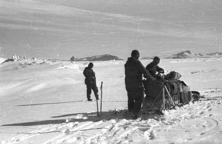
Food and paraffin began to run low, until they managed to reach a depot they had laid earlier in the trip.
“Monday 3rd September.
We struck camp and headed northwards in the deep soft snow. We soon found that we were making very little headway, and the dogs, sinking up to their bellies, got very little purchase for pulling, while the men without skis or snowshoes at the rear end of the sledges often involuntarily brought them to a halt through their inability to get their legs in and out of the snow quick enough. … Growing exhaustion compelled men and dogs to make a halt every 50 yards or so. James and Russell decided to relay again with half loads, while Taylor and I crawled on ahead at a snails pace for another mile or so, and finally made camp near a line or small embedded icebergs. The last of the dog pemmican was used up this evening, and we now rely for dog food on the cans of corned beef found at the Seymour Island depot; this will keep them going for another two days, during which we stand a fair chance of coming across a seal.
Thursday 6th September.
The day broke calm and bright, and to our delight … we ran onto an excellent hard windblown surface, over which we were able to make good brisk progress towards … Ross Island which marks the entrance to Sidney Herbert Sound. About an hour later however a sharp S.W wind sprang up, and soon developed into a blizzard with blinding drift snow whirling into our faces, for our course obliged us to head directly into it. Patches of frostbite began to appear on our faces, and it became increasingly difficult to get the dogs to go forward into the storm; but we had to keep on in order to get through to our depot before supplies became exhausted. Pitching the tents in the late afternoon was a job for us all, first one tent and then the other, and we were glad when at last we could creep inside and thaw the ice off our faces and make a cup of good hot cocoa on the primus. After eating our pemmican, we crept into our icy sleeping bags, after having extracted from them with a spoon as much as possible of the snow which the blizzard had forced into them. We covered a distance of 9 miles today.
Saturday 8th September.
… We set out towards Vega Island, with Taylor helping to pull on our foremost sledge, and out in the Crown Prince Gustav Channel soon got onto a good hard surface over which the dogs, even in their weakened state, were able to pull the sledges fairly easily, with our help. Approaching Vortex Island, Taylor and I took out team to the left, and James and Russell theirs to the right side of it, and finally we met the depot on its N.E. side. James extracted a tin of dog pemmican, our ration box, and the precious half can of paraffin… We made camp about half a mile away from a conspicuous horn-like promontory on Tabarin Island, and fed the dogs a double ration of pemmican. We much appreciated having the supply of paraffin for our stoves, this enabling us to dry out to a certain extent our wet footgear and other clothing, instead or merely thawing it out sufficiently to get into, as had been the case during the last few days.”
To read Lamb’s full account of the first Hope Bay sledging journey click here.
Gwion Davies describes the routine of making camp – even when the travelling had stopped for the day, there was still plenty of work to be done:
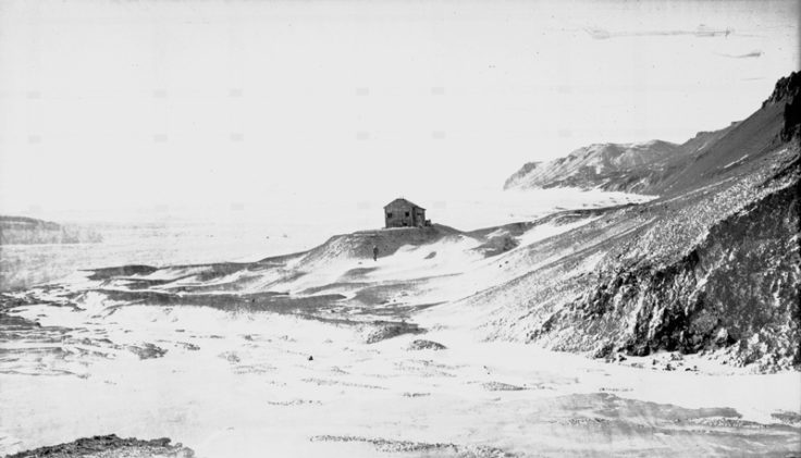
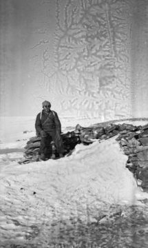
One of the highlights of the trip was finding the hut on Snow Hill Island at the eastern end of James Ross Island, built and lived in for two winters by Nordenskjold and five members of his Swedish Antarctic Expedition in 1902-03. In addition, the sledging party found depots laid by the earlier expedition, as well as notes left by the Argentine relief party who eventually rescued them:
“Monday 27th August.
The wind kept up during the night, but by the morning had abated considerably, so that we were able to go out. It was arranged that Taylor and I should go on with our team in an attempt to make Snow Hill that evening, while James and Russell tried to find Nordenskjold’s depot at Depot Point opposite our camp. Taylor and I therefore loaded our sledge and started off. … The ice surface was good until about 1400hrs, when we ran into a broad belt of uneven hummocky ice which caused the sledge to capsize several times. The drift was now blowing so thickly that during most of the time, the point on Snow Hill for which we were making was hidden from view, but finally the hilly northern part of the island loomed up before us, and Taylor went ahead to go up onto the shore. The sea ice here was for the most part bare and glassy, and it was difficult to manage the dogs and sledge on it. At last we came around the small ice spit which delimits the little bay at the head of which the Nordenskjold Hut stands, and we got our first glimpse of it, on top of a little scree hillock about 100yards from the shore. Leaving the sledge and dogs on the edge of the sea ice, we went to investigate, and were disappointed to find the hut in a bad state of disrepair, with windows gone and deep snow and ice lying inside. Articles of all kinds lay around inside and outside the hit, half embedded in snow and ice. We went back to our sledge, and lost no time in finding a fairly level spot on the hard snow by the shore on which to pitch our tent as the wind was blowing fairly strongly, and it felt bitterly cold (actually about -11F). During the night the temperature went down to -29F.
Thursday 30th August.
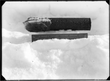
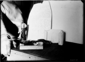
On this memorable day, Taylor and I left the camp at 0800hrs and headed across the island on foot in an easterly direction through a low valley which runs right across it, in order to look for Nordenskjold’s depot at Penguin Bay and also to collect fossils and botanical specimens. … I parted from Taylor in order to climb onto a 700ft plateau at the northern end of the island. …[S]eeing no sign of Taylor, I went down onto the sea ice and returned in the direction whence I had come in order to get back to the camp by lunchtime, as prearranged. … Shortly afterwards, Taylor arrived, having walked right around the northern part of the island and covered a distance of about 12miles. Towards the north end of the island he had found a cairn marked with a pole, at the base of which was a letter written on 7. November 1903 by two members of the Argentine Relief Expedition who had landed there from a gunboat “Uruguay”; it was in French; stating that they had been there on that date and had found under the cairn a paper with the signatures of Anderson and Sobral; apparently this is the cairn originally setup by Larsen in 1893. Taylor had not found any trace of the depot. … Taylor and I waited in our tent for the others to return. At about 1700hrs they arrived with their team, and delighted us with the news that they had located the depot, away to the south of the bay where Taylor and I had been searching for it. They brought back with them on the sledge a quantity of loaf sugar, canned corned beef, dried beans, rice, and a case of bottles of a liquor called “Hesperidine de Bagley”, which we thawed out and sampled, and found to be a kind of orange bitters. They also found a small tin canister sealed with adhesive tape and obviously containing some document; the opening of this will be deferred until we return to the base. Temperature -18F today.”
On the 11th September, the party safely returned to Hope Bay:
“A fine warm morning, and we felt quite content as we prepared to start out on the last 8 miles lap of our journey back to the base. … We had a rapid and uneventful run down to the base. Several figures came running out of the house to meet us. Greetings and handshaking all around, and many willing hands to help us unload the sledges and chain up the dogs. Into the house, everybody talking at the same time, a most welcome cup of tea from the galley, and we were at last back from our five weeks journey, happy, healthy and hungry.”
Source: Ivan Lamb base diary. (Archives ref: AD6/1A/1944/B)
The journey had achieved much – initial mapping of the area (the Eagle Archipelago and the east coast of Graham Land from Duse Bay to Cape Longing); a geological and botanical collection; meteorological observations; a series of magnetic observations; glaciological observations; general biological observations; a series of indexed photographs; and descriptions of the historical sites visited.